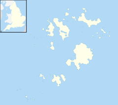
Bishop Rock, Isles of Scilly

Bishop Rock Lighthouse (2005)
|
|
|
Isles of Scilly
|
|
| Location | Isles of Scilly, Cornwall, United Kingdom |
|---|---|
| Coordinates | 49°52′22.52″N 06°26′44.49″W / 49.8729222°N 6.4456917°WCoordinates: 49°52′22.52″N 06°26′44.49″W / 49.8729222°N 6.4456917°W |
| Year first constructed | 1858 |
| Year first lit | 1887 (rebuilt) |
| Automated | 1992 |
| Construction | granite tower |
| Tower shape | tapered cylindrical tower with lantern and helipad on the top |
| Markings / pattern | unpainted tower, white lantern |
| Height | 51 metres (167 ft) |
| Focal height | 44 metres (144 ft) |
| Current lens | Hyper Radial 1330 mm Rotating |
| Intensity | 600,000 Candela |
| Range | 24 nautical miles (44 km; 28 mi) |
| Characteristic | Fl (2) W15s. |
| Admiralty number | A0002 |
| NGA number | 0004 |
| ARLHS number | ENG 010 |
| Managing agent | Trinity House |
The Bishop Rock (Cornish: Men Epskop) is a very small islet in the Atlantic Ocean known for its lighthouse. It is in the westernmost part of the Isles of Scilly, an archipelago 45 km (28 mi) off the southwestern tip of the Cornish peninsula of Great Britain. The Guinness Book of Records lists it as the world's smallest island with a building on it.
The original iron lighthouse was begun in 1847 but was washed away before it could be completed. The present building was completed in 1858 and was first lit on September 1, in the same year. Prior to the installation of the helipad, visitors to the lighthouse would rappel from the top (with winches installed at the lamp level and at the base below) to boats waiting away from the lighthouse.
Bishop Rock is also at the eastern end of the North Atlantic shipping route used by ocean liners in the first half of the 20th century; the western end being the entrance to Lower New York Bay. This was the route that ocean liners took when competing for the Transatlantic speed record, known as the Blue Riband.
In the late 13th century, when the Isles of Scilly were under the jurisdiction of John de Allet and his wife Isabella, anyone convicted of felony ″ought to be taken to a certain rock in the sea, with two barley loaves and a pitcher of water and left until the sea swallowed him up″. The rock was recorded as Maen Escop in 1284 and Maenenescop in 1302. In Welsh, Maen Esgob means Bishop Rock. The outer rocks to the west of St Agnes used to be known as the Bishop and Clerk, but exactly how they acquired their names is not known for certain. One explanation is that when a fleet of merchantmen out of Spain were wrecked 200 years ago, only Miles Bishop and John and Henry Clerk survived. Another possible explanation is that the shape of the rock is similar to a bishop's mitre.
...
Wikipedia

