Binnenmaas
| Binnenmaas | ||
|---|---|---|
| Municipality | ||

Lake Binnenmaas
|
||
|
||
 Location in South Holland |
||
| Coordinates: 51°48′N 4°33′E / 51.800°N 4.550°ECoordinates: 51°48′N 4°33′E / 51.800°N 4.550°E | ||
| Country | Netherlands | |
| Province | South Holland | |
| Government | ||
| • Body | Municipal council | |
| • Mayor | André Borgdorff (CDA) | |
| Area | ||
| • Total | 75.57 km2 (29.18 sq mi) | |
| • Land | 69.26 km2 (26.74 sq mi) | |
| • Water | 6.31 km2 (2.44 sq mi) | |
| Elevation | −1 m (−3 ft) | |
| Population (May 2014) | ||
| • Total | 28,670 | |
| • Density | 414/km2 (1,070/sq mi) | |
| Time zone | CET (UTC+1) | |
| • Summer (DST) | CEST (UTC+2) | |
| Postcode | 3270–3274, 3295–3299 | |
| Area code | 0186, 078 | |
| Website | www |
|
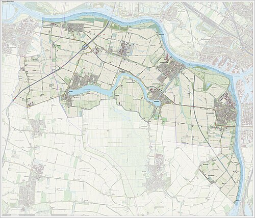
Binnenmaas (Dutch pronunciation: [ˈbɪnə(n)maːs]) is a municipality in the western Netherlands, in the province of South Holland. The municipality had a population of 28,670 in 2014, and covers an area of 75.57 km2 (29.18 sq mi) of which 6.31 km2 (2.44 sq mi) is water. It is named after the lake of the same name.
The municipality was formed on January 1, 1984, by the merger of the municipalities Puttershoek, Maasdam, Mijnsheerenland, Westmaas, and Heinenoord. On January 1, 2007, the municipality 's-Gravendeel was added to Binnenmaas.
The municipality of Binnenmaas consists of the following communities: Blaaksedijk, De Wacht, Goidschalxoord, 's-Gravendeel, Greup, Heinenoord, Kuipersveer, Maasdam, Maasdijk, Mijnsheerenland, Puttershoek, Reedijk, Schenkeldijk, Sint Anthoniepolder, Westdijk, Westmaas and Zwanegat.
...
Wikipedia

