Bighorn Canyon National Recreation Area
| Bighorn Canyon National Recreation Area | |
|---|---|
|
IUCN category V (protected landscape/seascape)
|
|

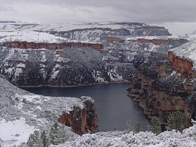
Snowfall on the Bighorn Canyon in the North District
|
|
| Location | Big Horn and Carbon counties, Montana & Big Horn County, Wyoming, USA |
| Nearest city | Billings, Montana |
| Coordinates | 45°11′40″N 108°7′50″W / 45.19444°N 108.13056°WCoordinates: 45°11′40″N 108°7′50″W / 45.19444°N 108.13056°W |
| Area | 120,296.22 acres (486.8215 km2) |
| Established | October 15, 1966 |
| Visitors | 201,010 (in 2011) |
| Governing body | National Park Service |
| Website | Bighorn Canyon National Recreation Area |
Bighorn Canyon National Recreation Area is a national park unit established by an act of Congress on October 15, 1966, following the construction of the Yellowtail Dam by the Bureau of Reclamation. It straddles the border between Wyoming and Montana. The dam, named after the famous Crow leader Robert Yellowtail, harnesses the waters of the Bighorn River by turning that variable watercourse into Bighorn Lake. The lake extends 71 miles (114 km) through Wyoming and Montana, 55 miles (89 km) of which lie within the national recreation area. About one third of the park unit is located on the Crow Indian Reservation. Nearly one-quarter of the Pryor Mountains Wild Horse Range lies within the Bighorn Canyon National Recreation Area.
Afterbay Lake, located below Yellowtail Dam, is a popular spot for trout fishing as well as for viewing ducks, geese and other animals. The Bighorn River below the Afterbay Dam is likewise a world-class trout fishing area. In addition, the area features many archeological and historical resources. Visitor centers and other developed facilities are located in Fort Smith, Montana and near Lovell, Wyoming.
Bighorn Canyon National Recreation Area has four historic ranches within its boundaries:
North of Lovell along the Sullivan Knob's Trail is one of the national recreation area's more unusual claims to fame. There a visitor can stand in a certain spot on the canyon rim, shout across the canyon and then hear a "triple echo" in reply.
The Bad Pass Trail runs through the Bighorn Canyon National Recreation Area. For thousands of years, this trail was used by prehistoric indigenous peoples, who may also have been following paths made by migrating game. During the winter, the prehistoric people would travel southward on the trail to reach the caves in the canyon, where they took shelter. In the spring, they would travel northward to hunting grounds in what is now called Montana. The trail is considered a cultural or sacred site by Native Americans, and in the 21st century, no one is allowed to walk or drive on it.
...
Wikipedia

