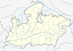
Betul, Madhya Pradesh
| Betul | |
|---|---|
| city | |
| Coordinates: 21°54′18″N 77°54′07″E / 21.905°N 77.902°ECoordinates: 21°54′18″N 77°54′07″E / 21.905°N 77.902°E | |
| Country | India |
| State | Madhya Pradesh |
| District | Betul |
| Elevation | 658 m (2,159 ft) |
| Population (2011) | |
| • Total | 103,330 |
| Languages | |
| • Official | Hindi |
| Time zone | IST (UTC+5:30) |
| ISO 3166 code | IN-MP |
| Vehicle registration | MP |
| Website | www |
Betul is a city and municipality in southern Madhya Pradesh, India. It is the administrative center of its eponymous district and forms the southernmost part of the Bhopal Division in the Betul-Harda Parliamentary Constituency. The district also includes Amla, which serves as a separate headquarters.
During the early 20th century, Betul was known as Badnur. It derives its present name from its surrounding district, which was named for its former headquarters at Betul Bazar, a small town about 5 km (3 mi) to its south. Betul—literally "without" (be) "cotton" (tool)—was named for its position outside the area's cottonfields.
Nearby Kherla was formerly the seat of an independent kingdom in the medieval and early modern period. Under Company Rule, its fort was permitted to fall into ruin. Badnur became the headquarters of Betul District in 1822. Surrounded by hills on all sides, it was used by the British for the exportation of coal. It supported two bazaars; the larger, Kothi Bazar, held 2015 people in the 1870s. At that time, the town had a circuit house, a dak bungalow, a caravanserai, jail, police station, pharmacy, and schools. Its population c. 1901 was 3766.
Following independence, Betul lay near the geographical center point of the new country, which is now marked by a stone at Barsali. Betul was connected to the Delhi–Chennai line of the Indian rail network in the early 1950s. It now serves as a junction point, providing the only access to the Chindwara District on broad-gauge rail.
...
Wikipedia

