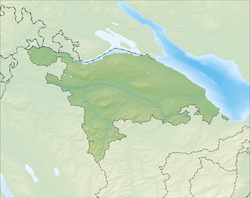
Bettwiesen
| Bettwiesen | ||
|---|---|---|
 |
||
|
||
| Coordinates: 47°30′N 9°2′E / 47.500°N 9.033°ECoordinates: 47°30′N 9°2′E / 47.500°N 9.033°E | ||
| Country | Switzerland | |
| Canton | Thurgau | |
| District | Münchwilen | |
| Area | ||
| • Total | 3.85 km2 (1.49 sq mi) | |
| Elevation | 550 m (1,800 ft) | |
| Population (Dec 2015) | ||
| • Total | 1,154 | |
| • Density | 300/km2 (780/sq mi) | |
| Postal code | 9553 | |
| SFOS number | 4716 | |
| Surrounded by | Bronschhofen (SG), Lommis, Münchwilen, Tobel-Tägerschen, Wängi | |
| Website |
www SFSO statistics |
|
Bettwiesen is a municipality in the district of Münchwilen in the canton of Thurgau in Switzerland.
Bettwiesen is first mentioned in 868 as Petterwison. During the Middle Ages it belonged to the Prince-Bishop of Constance's Tannegg district. In 1693 the entire district went to the monastery of Fischingen. The monastery had, since the Late Middle Ages, owned land in Bettwiesen and had built a castle in 1627.
St. Mary's Chapel in Bettwiesen was first mentioned in 1275 and was part of the parish of Wil under the monastery. The village converted to the new faith during the Protestant Reformation in 1530, but converted back to the Catholic faith during the Counter-Reformation in 1542. The Reformed population became part of the parish of Sirnach, and later (probably in the 18th century) the Affeltrangen parish. In 1646, the village split from the Wil parish to form a new, catholic parish.
Farmland and vineyards were replaced in 1900 by the livestock industry (1870 a cattle bank opened and in 1889 a dairy). After 1900, an embroidery factory and later a shoe factory (1936–79) opened in the village. In 1942, a galvanizing plant opened (in 1964, it had 235 employees). In 1990, 52% of workers worked in manufacturing, while 35% worked in the services sector.
Bettwiesen has an area, as of 2009[update], of 3.85 square kilometers (1.49 sq mi). Of this area, 2.43 km2 (0.94 sq mi) or 63.1% is used for agricultural purposes, while 0.88 km2 (0.34 sq mi) or 22.9% is forested. Of the rest of the land, 0.53 km2 (0.20 sq mi) or 13.8% is settled (buildings or roads), 0.01 km2 (2.5 acres) or 0.3% is either rivers or lakes.
...
Wikipedia


