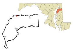
Betterton, Maryland
| Betterton, Maryland | |
|---|---|
| Town | |
 Location of Betterton, Maryland |
|
| Coordinates: 39°22′4″N 76°3′39″W / 39.36778°N 76.06083°WCoordinates: 39°22′4″N 76°3′39″W / 39.36778°N 76.06083°W | |
| Country | United States |
| State | Maryland |
| County | Kent |
| Government | |
| • Type | Mayor-Council |
| • Mayor | Donald E. Sutton |
| Area | |
| • Total | 1.00 sq mi (2.59 km2) |
| • Land | 0.99 sq mi (2.56 km2) |
| • Water | 0.01 sq mi (0.03 km2) |
| Elevation | 72 ft (22 m) |
| Population (2010) | |
| • Total | 345 |
| • Estimate (2012) | 339 |
| • Density | 348.5/sq mi (134.6/km2) |
| Time zone | Eastern (EST) (UTC-5) |
| • Summer (DST) | EDT (UTC-4) |
| ZIP code | 21610 |
| Area code(s) | 410 |
| FIPS code | 24-07200 |
| GNIS feature ID | 0583196 |
| Website | townofbetterton.com |
|
Betterton Historic District
|
|

Rigbie Hotel
|
|
| Location | Roughly bounded by Sassafras River, Gut Marsh, 6th, and Ericsson Aves., Betterton, Maryland |
|---|---|
| Coordinates | 39°22′2″N 76°3′47″W / 39.36722°N 76.06306°W |
| Built | 1880 |
| Architectural style | Gothic |
| NRHP Reference # | |
| Added to NRHP | June 07, 1984 |
Betterton is a town in Kent County, Maryland, United States. The population was 345 at the 2010 census.
The Betterton Historic District consists of a collection of vernacular Victorian resort structures. The district includes many of the homes, hotels and cottages built to accommodate steamboat passengers in the late 19th and early 20th centuries. Notable buildings within the district include the hotels and boarding homes which catered to the steamboat passengers, several churches, and summer cottages, dating from the golden age of the passenger steamboats on the Chesapeake Bay.
It was added to the National Register of Historic Places in 1984.
Betterton is located at the mouth of the Sassafras River on the upper Chesapeake Bay. More precisely, Betterton is located at 39°22′4″N 76°3′39″W / 39.36778°N 76.06083°W (39.367863, -76.060877).
According to the United States Census Bureau, the town has a total area of 1.00 square mile (2.59 km2), of which, 0.99 square miles (2.56 km2) is land and 0.01 square miles (0.03 km2) is water.
Betterton is governed by a mayor and a town council with four members. Town council meetings are held on the second and fourth Tuesday of every month at 7:00 pm in the town hall. The town hall is located in the Betterton Community Center, a former Catholic church refurbished as town offices and a museum, on Main Street.
...
Wikipedia


