Bethlehem, New Hampshire
| Bethlehem, New Hampshire | |
|---|---|
| Town | |

Main street of Bethlehem, spring 2009
|
|
| Motto: Star of the White Mountains | |
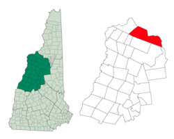
 Location in Grafton County, New Hampshire |
|
| Coordinates: 44°16′49″N 71°41′17″W / 44.28028°N 71.68806°WCoordinates: 44°16′49″N 71°41′17″W / 44.28028°N 71.68806°W | |
| Country | United States |
| State | New Hampshire |
| County | Grafton |
| Incorporated | 1799 |
| Government | |
| • Board of Selectmen | Martin Glavac, Chair Libby Staples Gerald Blanchard Richard Ubaldo Sandy Laleme |
| Area | |
| • Total | 91.0 sq mi (235.6 km2) |
| • Land | 90.6 sq mi (234.7 km2) |
| • Water | 0.3 sq mi (0.9 km2) 0.39% |
| Elevation | 1,426 ft (435 m) |
| Population (2010) | |
| • Total | 2,526 |
| • Density | 28/sq mi (11/km2) |
| Time zone | Eastern (UTC-5) |
| • Summer (DST) | Eastern (UTC-4) |
| ZIP code | 03574 |
| Area code(s) | 603 |
| FIPS code | 33-05460 |
| GNIS feature ID | 0873546 |
| Website | www |
Bethlehem is a hillside town in Grafton County, New Hampshire, United States. The population was 2,526 at the 2010 census. It is home to Cushman and Strawberry Hill state forests. The eastern half of the town is within the White Mountain National Forest. The Appalachian Trail crosses in the south.
The main village of the town, where 972 people resided at the 2010 census, is defined as the Bethlehem census-designated place (CDP), and is located at the junction of U.S. Route 302 with New Hampshire Route 142. The town also includes the villages of Maplewood and Pierce Bridge.
Granted as Lloyd's Hills in 1774 by Colonial Governor John Wentworth, the town was named for James Lloyd of Boston. It would be the last of the provincial grants in New Hampshire. In the aftermath of the Revolutionary War, the original grant could not be found. Lack of documentation would deter settlement until 1787, when the first permanent houses were built. Dropping its homage to Lloyd, a Loyalist, the town would be incorporated as Bethlehem on December 27, 1799, the name selected on the last Christmas Day of the century. There were just 33 families, with agriculture the only industry.
By 1850, however, the population had grown to 950, and the town contained a gristmill, 5 large sawmills and 2 starch factories. Then, in 1867, the railroad came to Bethlehem Junction. With it traveled tourists from Boston, New York and elsewhere, many to avoid respiratory ailments in the low pollen count environment of "the highest town in New Hampshire" (as claimed on a present-day sign in the village, although several other towns in the state are higher). Others were attracted by the paintings of the White Mountain artists. Conveniently located near Mount Washington and other attractions of the White Mountains, Bethlehem developed into a Gilded Age resort for the rich and famous.
...
Wikipedia
