Besztercebánya
| Banská Bystrica | |||
| City | |||
|
Banská Bystrica's main square
|
|||
|
|||
| Name origin: "mining creek" | |||
| Country | Slovakia | ||
|---|---|---|---|
| River | Hron | ||
| Elevation | 362 m (1,188 ft) | ||
| Coordinates | 48°43′57″N 19°08′57″E / 48.73250°N 19.14917°ECoordinates: 48°43′57″N 19°08′57″E / 48.73250°N 19.14917°E | ||
| Area | 103.37 km2 (39.91 sq mi) | ||
| Population | 78 327 (31 December 2011) | ||
| Density | 775/km2 (2,007/sq mi) | ||
| First mentioned | 1255 | ||
| Mayor | Ján Nosko (Independent (supported by SMER)) | ||
| Timezone | CET (UTC+1) | ||
| - summer (DST) | CEST (UTC+2) | ||
| Postal code | 97401 | ||
| Area code | +421-48 | ||
| Car plate | BB | ||
| Statistics: MOŠ/MIS | |||
| Website: eng.banskabystrica.sk | |||
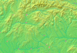
Banská Bystrica (Slovak pronunciation: [ˈbanskaː ˈbistritsa], also known by other alternative names) is a city in central Slovakia located on the Hron River in a long and wide valley encircled by the mountain chains of the Low Tatras, the Veľká Fatra, and the Kremnica Mountains. With 78 327 inhabitants, Banská Bystrica is the sixth most populous municipality in Slovakia. The present town was founded by German settlers, however it was built upon a former Slavic settlement. It obtained the municipal privileges of a free royal town of the Kingdom of Hungary in 1255. The copper mining town acquired its present picturesque look in the Late Middle Ages when the prosperous burghers built its central churches, mansions, and fortifications. It is the capital of the kraj (Banská Bystrica Region) and the okres (Banská Bystrica District). It is also the home of Matej Bel University. As a historical city with an easy access to the surrounding mountains, Banská Bystrica is a popular winter and summer tourist destination.
The earliest history of Banská Bystrica was connected with the exploitation of its abundant deposits of copper (and to a lesser extent of silver, gold, and iron). The tools used by prehistoric miners at the locality called Špania Dolina have been dated to 2000–1700 BCE. People of the Lusatian culture built their settlements at Špania Dolina, Horné Pršany, Malachov, and Sásová. Ancient hill fort locations are still reflected in the local toponym Hrádok, meaning "a small fort (later: castle)". The territory was inhabited by the Celtic tribe of the Cotini (Púchov culture) in the 3rd century BCE. The Germanic tribe of the Quadi took over the place during the Roman Era, leaving for instance a hoard of silver artifacts in Netopierska jaskyňa (Bat Cave).
...
Wikipedia


