Bernardston, Massachusetts
| Bernardston, Massachusetts | ||
|---|---|---|
| Town | ||

The former Powers Institute, now the town's Historical Society
|
||
|
||
| Nickname(s): Falltown | ||
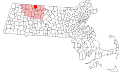
 Location in Franklin County in Massachusetts |
||
| Coordinates: 42°40′15″N 72°33′00″W / 42.67083°N 72.55000°WCoordinates: 42°40′15″N 72°33′00″W / 42.67083°N 72.55000°W | ||
| Country | United States | |
| State | Massachusetts | |
| County | Franklin | |
| Settled | 1738 | |
| Incorporated | 1762 | |
| Government | ||
| • Type | Open town meeting | |
| Area | ||
| • Total | 23.4 sq mi (60.6 km2) | |
| • Land | 23.4 sq mi (60.6 km2) | |
| • Water | 0.0 sq mi (0.0 km2) | |
| Elevation | 360 ft (110 m) | |
| Population (2010) | ||
| • Total | 2,129 | |
| • Density | 91/sq mi (35/km2) | |
| Time zone | Eastern (UTC-5) | |
| • Summer (DST) | Eastern (UTC-4) | |
| ZIP code | 01337 | |
| Area code(s) | 413 | |
| FIPS code | 25-05560 | |
| GNIS feature ID | 0619378 | |
| Website | townofbernardston |
|
Bernardston /ˈbərnərdstən/ is a town in Franklin County, Massachusetts, United States. The population was 2,129 at the 2010 census. It is part of the Springfield, Massachusetts Metropolitan Statistical Area.
Bernardston, Massachusetts, initially known as Falls Fight Township. was a frontier settlement created by and for the families of soldiers who had fought in King Phillips War specifically in the Battle of Turner's Falls a major engagement under Captain Turner in 1676.Major John Burke was an early settler of the town, his father was one of the veterans granted land in Falls Fight.
In November, 1734, the following was presented to the General Court of Massachusetts
"A petition of Samuel Hunt, of Billerica, for himself and other survivors of the officers and soldiers that belonged to the company of Capt. Turner, and the representatives of them that are dead, shewing that the said company in 1676 engaged the Indian enemy at a place above Deerfield, and destroyed above three hundred of them, and, therefore, praying that this court would grant them a tract of land above Deerfield suitable to make a township."
The petition was granted and the proprietors of the new township began recruiting 60 families to settle in the town. John Burke, Samuel Connable, Lieut. Ebenezer Sheldon, and Deacon Sheldon, built the first four houses, in 1738. They were of hewn logs, with port-holes in the walls for defence against the Indians.
At his own expense, Burke built a stockade fort that stood "six rods on each side" (6 rods being about 100 feet). The stockade walls stood 12 feet high behind which the inhabitants in the vicinity repaired every night during the periods of Indian troubles. The fort contained eight homes, protecting the settlement during Indian attacks beginning in 1745 and later the French and Indian War.
...
Wikipedia

