Berlin-Marienfelde
| Marienfelde | |
|---|---|
| Quarter of Berlin | |

Village Church
|
|
| Coordinates: 52°25′00″N 13°22′00″E / 52.41667°N 13.36667°ECoordinates: 52°25′00″N 13°22′00″E / 52.41667°N 13.36667°E | |
| Country | Germany |
| State | Berlin |
| City | Berlin |
| Borough | Tempelhof-Schöneberg |
| Founded | 1220 |
| Area | |
| • Total | 9.15 km2 (3.53 sq mi) |
| Elevation | 40 m (130 ft) |
| Population (2008-06-30) | |
| • Total | 30,151 |
| • Density | 3,300/km2 (8,500/sq mi) |
| Time zone | CET/CEST (UTC+1/+2) |
| Postal codes | (nr. 0705) 12277, 12279 |
| Vehicle registration | B |
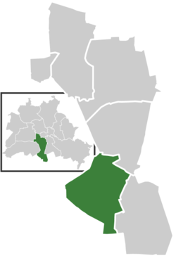
![]() Marienfelde is a locality in southwest Berlin, Germany, part of the Tempelhof-Schöneberg borough. The former village, incorporated according to the Greater Berlin Act of 1920, today is a mixed industrial and residential area.
Marienfelde is a locality in southwest Berlin, Germany, part of the Tempelhof-Schöneberg borough. The former village, incorporated according to the Greater Berlin Act of 1920, today is a mixed industrial and residential area.
The Marienfelde quarter borders the Tempelhof-Schöneberg localities of Mariendorf in the northeast and Lichtenrade in the southeast. In the west, it borders on Lankwitz, part of the Steglitz-Zehlendorf borough. In the south, it is bounded by the Berlin city limits and the border with the state of Brandenburg.
The medieval Angerdorf arose together with neighbouring Mariendorf during the German Ostkolonisation migration about 1220 AD, then affiliated with the Teltow estates held by the Knights Templar commandry at Tempelhof. A fieldstone church was erected around 1240 which, still preserved, is one of the oldest in the Berlin area.
The settlement of Merghenvelde itself was first mentioned in a 1344 deed, after the Brandenburg lands of the Knights Templar had passed to the Order of Saint John. From 1435 onwards, the estates were held by the City of Berlin. Located in the southwestern suburbs of the Prussian capital, population increased from the mid-19th century on. The historic village centre was largely destroyed during the bombing of Berlin in World War II.
...
Wikipedia


