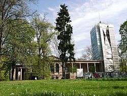
Berlin-Biesdorf
| Biesdorf | |
|---|---|
| Quarter of Berlin | |

|
|
| Coordinates: 52°30′33″N 13°33′19″E / 52.50917°N 13.55528°ECoordinates: 52°30′33″N 13°33′19″E / 52.50917°N 13.55528°E | |
| Country | Germany |
| State | Berlin |
| City | Berlin |
| Borough | Marzahn-Hellersdorf |
| Founded | 1375 |
| Area | |
| • Total | 12.4 km2 (4.8 sq mi) |
| Elevation | 50 m (160 ft) |
| Population (2009-12-31) | |
| • Total | 24,543 |
| • Density | 2,000/km2 (5,100/sq mi) |
| Time zone | CET/CEST (UTC+1/+2) |
| Postal codes | 12683 |
| Vehicle registration | B |
Biesdorf is a locality (Ortsteil) within the Berlin borough (Bezirk) of Marzahn-Hellersdorf. Until 2001 it was part of the former borough of Marzahn.
Biesdorf was mentioned for the first time in a document of 1375, the "Landbuch" (land book) of Charles IV, with its ancient names Bysterstorff and/or Bisterstorff. Until 1920 it was a municipality of the former Niederbarnim district, merged in Berlin with the "Greater Berlin Act", and part of Lichtenberg district until 1933. From 1949 to 1990, during the "Cold War", it was part of East Berlin.
Located in the eastern suburb of Berlin, Biesdorf border with Marzahn, Hellersdorf, Kaulsdorf, Friedrichsfelde, Karlshorst (both in Lichtenberg district) and Köpenick (in Treptow-Köpenick). Its tallest point is a hill, Biesdorfer Höhe, of 82 amsl, part of the Wuhletal park. Biesdorf counts the lakes of Biesdorfer Baggersee, Dreiecksee, Wuhleteich and Wuhlesee, on the river Wuhle, that separates it from Kaulsdorf. Little portions of Tierpark and Erholungspark Marzahn belongs to Biesdorf.
Biesdorf is divided into 2 zones (Ortslagen):
As urban rail, the locality is served both by S-Bahn and U-Bahn, at the stations of Biesdorf (line S5), Wuhletal, (S5 and U5), Biesdorf-Süd (U5) and Elsterwerdaer Platz (U5). "Allee der Kosmonauten", a road in Marzahn bordering with Biesdorf, is crossed by the tramway lines M8 and 18.
...
Wikipedia


