Beresford, South Dakota
| Beresford, South Dakota | |
|---|---|
| City | |
 |
|
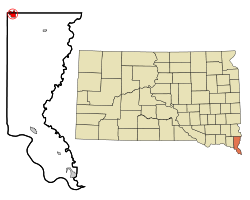
 Location in Union County and the state of South Dakota |
|
| Coordinates: 43°4′51″N 96°46′34″W / 43.08083°N 96.77611°WCoordinates: 43°4′51″N 96°46′34″W / 43.08083°N 96.77611°W | |
| Country | United States |
| State | South Dakota |
| Counties | Union, Lincoln |
| Incorporated | July 12, 1884 |
| Government | |
| • Mayor | Jim Fedderson |
| • City Council |
Councilmembers
|
| Area | |
| • Total | 1.78 sq mi (4.61 km2) |
| • Land | 1.78 sq mi (4.61 km2) |
| • Water | 0 sq mi (0 km2) |
| Elevation | 1,499 ft (457 m) |
| Population (2010) | |
| • Total | 2,005 |
| • Estimate (2015) | 1,976 |
| • Density | 1,126.4/sq mi (434.9/km2) |
| Time zone | Central (CST) (UTC-6) |
| • Summer (DST) | CDT (UTC-5) |
| ZIP code | 57004 |
| Area code(s) | 605 |
| FIPS code | 46-04980 |
| GNIS feature ID | 1267667 |
| Website | www.beresfordsd.com |
Beresford is a city in Lincoln and Union counties in the State of South Dakota. The population was 2,005 as of the 2010 census. The southern two-thirds is part of the Sioux City, IA-NE-SD Metropolitan Statistical Area, while the northern one-third is part of the Sioux Falls Metropolitan Statistical Area. The Beresford Republic is the weekly newspaper.
Beresford was originally called Paris, and under the latter name was laid out in 1873. The city was renamed after Lord Charles Beresford and was formally incorporated on July 12, 1884.
Beresford is located at 43°4′51″N 96°46′34″W / 43.08083°N 96.77611°W (43.080859, -96.776148).
According to the United States Census Bureau, the city has a total area of 1.78 square miles (4.61 km2), all land.
Beresford is located on the border between Lincoln and Union counties; the border between the counties is located along Beresford's Cedar Street. Approximately two-thirds of Beresford's area (including its city hall building) is located in Union County.
...
Wikipedia
