Benton, Kansas
| Benton, Kansas | |
|---|---|
| City | |

Circle Middle School (2006)
|
|
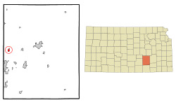
 Location within Butler County and Kansas |
|
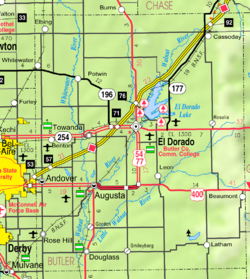
 KDOT map of Butler County (legend) |
|
| Coordinates: 37°47′21″N 97°6′30″W / 37.78917°N 97.10833°WCoordinates: 37°47′21″N 97°6′30″W / 37.78917°N 97.10833°W | |
| Country | United States |
| State | Kansas |
| County | Butler |
| Incorporated | January 6, 1909 |
| Government | |
| • Type | Council-Mayor |
| • Mayor | Ken Gile |
| Area | |
| • Total | 1.39 sq mi (3.60 km2) |
| • Land | 1.39 sq mi (3.60 km2) |
| • Water | 0 sq mi (0 km2) |
| Elevation | 1,375 ft (419 m) |
| Population (2010) | |
| • Total | 880 |
| • Estimate (2015) | 876 |
| • Density | 630/sq mi (240/km2) |
| Time zone | Central (CST) (UTC-6) |
| • Summer (DST) | CDT (UTC-5) |
| ZIP code | 67017 |
| Area code | 316 |
| FIPS code | 20-06175 |
| GNIS feature ID | 0473887 |
| Website | BentonKS.org |
Benton is a city in Butler County, Kansas, United States. As of the 2010 census, the city population was 880.
Benton is located at 37°47′21″N 97°6′30″W / 37.78917°N 97.10833°W (37.789302, -97.108402). According to the United States Census Bureau, the city has a total area of 1.39 square miles (3.60 km2), all of it land.
Benton was founded in 1884. It was named for Thomas Benton Murdock, a state politician. Benton was incorporated as a city in 1908.
In 1969, part of the film The Gypsy Moths was shot in the Benton area.
As of the census of 2010, there were 880 people, 325 households, and 254 families residing in the city. The population density was 633.1 inhabitants per square mile (244.4/km2). There were 360 housing units at an average density of 259.0 per square mile (100.0/km2). The racial makeup of the city was 97.3% White, 0.1% African American, 0.6% Native American, 0.7% Asian, 0.5% from other races, and 0.9% from two or more races. Hispanic or Latino of any race were 2.7% of the population.
...
Wikipedia
