Belvidere (NJ)
| Belvidere, New Jersey | |
|---|---|
| Town | |
| Town of Belvidere | |

Twin mills in Belvidere Historic District
|
|
 Map of Belvidere in Warren County. Inset: Location of Warren County highlighted in the State of New Jersey. |
|
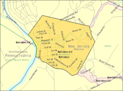
 Census Bureau map of Belvidere, New Jersey |
|
| Coordinates: 40°49′47″N 75°04′24″W / 40.829802°N 75.073337°WCoordinates: 40°49′47″N 75°04′24″W / 40.829802°N 75.073337°W | |
| Country | |
| State |
|
| County | Warren |
| Incorporated | April 7, 1845 |
| Named for | Italian language "beautiful to see" |
| Government | |
| • Type | Town |
| • Body | Town Council |
| • Mayor | Joseph M. Kennedy Sr. (R, term ends December 31, 2019) |
| • Administrator / Municipal clerk | Teresa A. Yeisley |
| Area | |
| • Total | 1.490 sq mi (3.859 km2) |
| • Land | 1.452 sq mi (3.759 km2) |
| • Water | 0.038 sq mi (0.100 km2) 2.58% |
| Area rank | 452nd of 566 in state 22nd of 22 in county |
| Elevation | 266 ft (81 m) |
| Population (2010 Census) | |
| • Total | 2,681 |
| • Estimate (2016) | 2,602 |
| • Rank | 462nd of 566 in state 16th of 22 in county |
| • Density | 1,847.0/sq mi (713.1/km2) |
| • Density rank | 301st of 566 in state 4th of 22 in county |
| Time zone | Eastern (EST) (UTC-5) |
| • Summer (DST) | Eastern (EDT) (UTC-4) |
| ZIP code | 07823 |
| Area code(s) | 908 exchange: 475, 750, 818, 841 |
| FIPS code | 3404104990 |
| GNIS feature ID | 885156 |
| Website | www |
Belvidere is a town in Warren County, New Jersey, United States. As of the 2010 United States Census, the town's population was 2,681, reflecting a decline of 90 (-3.2%) from the 2,771 counted in the 2000 Census, which had in turn increased by 102 (+3.8%) from the 2,669 counted in the 1990 Census. It is the county seat of Warren County. Belvidere is located in the eastern section of the Lehigh Valley.
Belvidere was incorporated as a town by an act of the New Jersey Legislature on April 7, 1845, from portions of Oxford Township, based on the results of a referendum held that day. The town's name means "beautiful to see" in Italian.
According to the United States Census Bureau, the town had a total area of 1.490 square miles (3.859 km2), including 1.452 square miles (3.759 km2) of land and 0.038 square miles (0.100 km2) of water (2.58%).
Dildine Island is located in the Delaware River, approximately 4 miles (6.4 km) north of Belvidere.
As of the 2010 United States Census, there were 2,681 people, 1,054 households, and 681.9 families residing in the town. The population density was 1,847.0 per square mile (713.1/km2). There were 1,140 housing units at an average density of 785.4 per square mile (303.2/km2). The racial makeup of the town was 96.01% (2,574) White, 1.57% (42) Black or African American, 0.11% (3) Native American, 0.78% (21) Asian, 0.00% (0) Pacific Islander, 0.22% (6) from other races, and 1.31% (35) from two or more races. Hispanic or Latino of any race were 3.62% (97) of the population.
...
Wikipedia
