Belper
| Belper | |
|---|---|
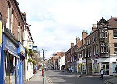
 King Street |
|
 Belper parish highlighted within Derbyshire |
|
| Population | 21,823 (civil parish, 2011) |
| OS grid reference | SK351476 |
| Civil parish |
|
| District | |
| Shire county | |
| Region | |
| Country | England |
| Sovereign state | United Kingdom |
| Post town | BELPER |
| Postcode district | DE56 |
| Dialling code | 01773 |
| Police | Derbyshire |
| Fire | Derbyshire |
| Ambulance | East Midlands |
| EU Parliament | East Midlands |
| UK Parliament | |
Coordinates: 53°01′44″N 1°28′30″W / 53.029°N 1.475°W
Belper is a town and civil parish in the local government district of Amber Valley in Derbyshire, England, located about 7 miles (11 km) north of Derby on the River Derwent. As well as Belper itself, the parish also includes the village of Milford and the hamlets of Bargate, Blackbrook and Makeney. As of the 2011 Census, the parish had a population of 21,823. Originally a centre for the nail-making industry since Medieval times, Belper expanded during the early Industrial Revolution to become one of the first mill towns with the establishment of several textile mills; as such, it forms part of the Derwent Valley Mills World Heritage Site.
At the time of the Norman occupation, Belper was part of the land centred on Duffield held by the family of Henry de Ferrers. The Domesday Survey records a manor of "Bradley" which is thought to have stood in an area of town now known as the Coppice. At that time it was probably within the Forest of East Derbyshire which covered the whole of the county east of the Derwent. It was possibly appropriated by William de Ferrers, 4th Earl of Derby at some time after it was disafforested in 1225 and became part of Duffield Frith.
...
Wikipedia
