Beloit, Ohio
| Beloit, Ohio | |
|---|---|
| Village | |

West Branch High School on Beloit-Snodes Road
|
|
 Location of Beloit, Ohio |
|
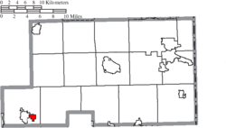
 Location of Beloit in Mahoning County |
|
| Coordinates: 40°55′22″N 80°59′50″W / 40.92278°N 80.99722°WCoordinates: 40°55′22″N 80°59′50″W / 40.92278°N 80.99722°W | |
| Country | United States |
| State | Ohio |
| County | Mahoning |
| Township | Smith |
| Area | |
| • Total | 0.99 sq mi (2.56 km2) |
| • Land | 0.98 sq mi (2.54 km2) |
| • Water | 0.01 sq mi (0.03 km2) |
| Elevation | 1,129 ft (344 m) |
| Population (2010) | |
| • Total | 978 |
| • Estimate (2012) | 962 |
| • Density | 998.0/sq mi (385.3/km2) |
| Time zone | Eastern (EST) (UTC-5) |
| • Summer (DST) | EDT (UTC-4) |
| ZIP code | 44609 |
| Area code(s) | 330 |
| FIPS code | 39-05410 |
| GNIS feature ID | 1064412 |
Beloit is a village in Mahoning County, Ohio, United States. The population was 978 at the 2010 census. It is part of the Youngstown-Warren-Boardman, OH-PA Metropolitan Statistical Area.
Beloit had its start in the late 1840s by the building of the railroad through that territory. It was originally called Smithfield Station, and the name Beloit was adopted in 1863. The name Beloit is a transfer from Beloit, Wisconsin.
Beloit is located at 40°55′22″N 80°59′50″W / 40.92278°N 80.99722°W (40.922866, -80.997176).
According to the United States Census Bureau, the village has a total area of 0.99 square miles (2.56 km2), of which 0.98 square miles (2.54 km2) is land and 0.01 square miles (0.03 km2) is water.
As of the census of 2010, there were 978 people, 425 households, and 275 families residing in the village. The population density was 998.0 inhabitants per square mile (385.3/km2). There were 468 housing units at an average density of 477.6 per square mile (184.4/km2). The racial makeup of the village was 97.3% White, 0.3% African American, 0.1% Native American, 0.4% Asian, and 1.8% from two or more races. Hispanic or Latino of any race were 0.3% of the population.
...
Wikipedia
