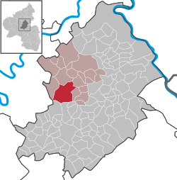
Bell (Hunsrück)
| Bell | ||
|---|---|---|
|
||
| Coordinates: 50°3′43.40″N 7°24′53.65″E / 50.0620556°N 7.4149028°ECoordinates: 50°3′43.40″N 7°24′53.65″E / 50.0620556°N 7.4149028°E | ||
| Country | Germany | |
| State | Rhineland-Palatinate | |
| District | Rhein-Hunsrück-Kreis | |
| Municipal assoc. | Kastellaun | |
| Government | ||
| • Mayor | Kurt Baumgarten | |
| Area | ||
| • Total | 23.53 km2 (9.08 sq mi) | |
| Elevation | 420 m (1,380 ft) | |
| Population (2015-12-31) | ||
| • Total | 1,450 | |
| • Density | 62/km2 (160/sq mi) | |
| Time zone | CET/CEST (UTC+1/+2) | |
| Postal codes | 56288 | |
| Dialling codes | 06762 | |
| Vehicle registration | SIM | |
| Website | www |
|
Bell (Hunsrück) is an Ortsgemeinde – a municipality belonging to a Verbandsgemeinde, a kind of collective municipality – in the Rhein-Hunsrück-Kreis (district) in Rhineland-Palatinate, Germany. It belongs to the Verbandsgemeinde of Kastellaun, whose seat is in the like-named town.
The municipality lies in the Hunsrück. The main centre – there are six Ortsteile – with its 479 inhabitants (as at 30 June 2009) lies roughly one kilometre from Kastellaun and the Hunsrückhöhenstraße (“Hunsrück Heights Road”, a scenic road across the Hunsrück built originally as a military road on Hermann Göring’s orders) on the edge of the hollow where the streams rise that form the Mörsdorfer Bach, which flows down to Castle Balduinseck where it empties into the Flaumbach, itself a tributary to the Moselle.
Bell’s Ortsteile are the main centre, also called Bell, and the outlying centres of Hundheim, Krastel, Leideneck, Wohnroth and Völkenroth along with the Blümlingshof and the Rothenberger Hof.
In 1220, Bell had its first documentary mention in the directory of yearly payments to the Archbishopric of Trier, the liber annalium. Even so, Bell is a much older settlement. The name itself is pre-Germanic, being a Celtic word for a hill or a settlement in the heights. Grave finds near Bell, particularly the Wagon Grave of Bell from late Hallstatt times (about 500 BC), show that the area was settled by Celts.
...
Wikipedia


