Beerfelden
| Beerfelden | ||
|---|---|---|
|
||
| Coordinates: 49°34′N 8°58′E / 49.567°N 8.967°ECoordinates: 49°34′N 8°58′E / 49.567°N 8.967°E | ||
| Country | Germany | |
| State | Hesse | |
| Admin. region | Darmstadt | |
| District | Odenwaldkreis | |
| Government | ||
| • Mayor | Gottfried Görig | |
| Area | ||
| • Total | 71.18 km2 (27.48 sq mi) | |
| Elevation | 397 m (1,302 ft) | |
| Population (2015-12-31) | ||
| • Total | 6,399 | |
| • Density | 90/km2 (230/sq mi) | |
| Time zone | CET/CEST (UTC+1/+2) | |
| Postal codes | 64743 | |
| Dialling codes | 06068 | |
| Vehicle registration | ERB | |
| Website | www.beerfelden.de | |
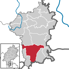
Beerfelden (Pronunciation: ˈbeːɐˌfɛldən) is a town in the Odenwald in the Odenwaldkreis (district) in Hesse, Germany, 28 km northeast of Heidelberg. The region around Beerfelden has for tourist reasons been dubbed the Beerfelder Land.
Beerfelden lies in the Odenwald at elevations from 330 to 540 m. Towards the south stretches the narrow, wooded Gammelsbach Valley, in which are found the Freienstein castle ruins, down to the Neckar.
The Beerfelder Land is a tourist region that lies between Beerfelden, the communities of Rothenberg, Sensbachtal and Hesseneck in the Geo-Naturpark Bergstraße-Odenwald and which is one of the Odenwald’s most richly forested areas. The Beerfelder Land lies at elevations from 200 to 555 m above sea level. Within it is the 626 m-high Katzenbuckel near Waldkatzenbach, which is part of a chain of heights running north-south.
To the east stands the Krähberg hunting castle (Jagdschloss) that once belonged to the Counts of Erbach-Fürstenau, under which runs a railway tunnel, the Krähbergtunnel, which was at the time of its building one of Germany’s longest at 3.1 km (elevation: 348 m).
Beerfelden borders in the north on the community of Mossautal and the town of Erbach, in the east on the communities of Hesseneck and Sensbachtal, in the south on the town of Eberbach (Rhein-Neckar-Kreis in Baden-Württemberg) and the community of Rothenberg and in the west on the community of Wald-Michelbach (Kreis Bergstraße).
...
Wikipedia


