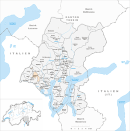
Bedigliora
| Bedigliora | ||
|---|---|---|

Bedigliora village church
|
||
|
||
| Coordinates: 46°0′N 8°51′E / 46.000°N 8.850°ECoordinates: 46°0′N 8°51′E / 46.000°N 8.850°E | ||
| Country | Switzerland | |
| Canton | Ticino | |
| District | Lugano | |
| Government | ||
| • Mayor | Sindaco | |
| Area | ||
| • Total | 2.48 km2 (0.96 sq mi) | |
| Elevation | 617 m (2,024 ft) | |
| Population (Dec 2015) | ||
| • Total | 635 | |
| • Density | 260/km2 (660/sq mi) | |
| Postal code | 6981 | |
| SFOS number | 5149 | |
| Surrounded by | Croglio, Curio, Novaggio, Pura, Sessa | |
| Website |
www SFSO statistics |
|
Bedigliora is a municipality in the district of Lugano in the canton of Ticino in Switzerland.
Bedigliora is first mentioned in 1335 as Bedaliola. The settlement of Banco is first mentioned as Bango in 1421.
Traces of prehistoric settlements in the area include a Neolithic era ax, tombs from the Iron Age, a stele with northern Etruscan inscriptions and a domed grave. During the Middle Ages, Bedigliora and Banco along with Curio and Novaggio formed a Kastlanei.
The provost's Church of St. Roch was consecrated in 1644, however it was built over an older chapel. The church of San Salvatore in Banco goes back to the Middle Ages and was originally the religious and secular center of the Kastlanei. In 1612, Bedigliora became the seat of the parish church.
The temporary emigration of earlier centuries has been replaced by a largely commuting population. In 1990, about two-thirds of the population commuted, mostly to Lugano.
Bedigliora has a primary and a secondary school.
Bedigliora has an area, as of 1997[update], of 2.48 square kilometers (0.96 sq mi). Of this area, 0.44 km2 (0.17 sq mi) or 17.7% is used for agricultural purposes, while 1.91 km2 (0.74 sq mi) or 77.0% is forested. Of the rest of the land, 0.33 km2 (0.13 sq mi) or 13.3% is settled (buildings or roads).
Of the built up area, housing and buildings made up 8.5% and transportation infrastructure made up 3.6%. Out of the forested land, 69.8% of the total land area is heavily forested and 7.3% is covered with orchards or small clusters of trees. Of the agricultural land, 8.5% is used for growing crops and 8.5% is used for alpine pastures.
The municipality is located in the Lugano district, on the southern slope of Monte Bedeglia in the mid-Malcantone valley. It consists of the village of Bedigliora and the hamlets of Nerocco, Beride and Banco.
...
Wikipedia


