Becherbach bei Kirn
| Becherbach bei Kirn | ||
|---|---|---|
|
||
| Coordinates: 49°44′28″N 7°30′01″E / 49.74111°N 7.50028°ECoordinates: 49°44′28″N 7°30′01″E / 49.74111°N 7.50028°E | ||
| Country | Germany | |
| State | Rhineland-Palatinate | |
| District | Bad Kreuznach | |
| Municipal assoc. | Kirn-Land | |
| Government | ||
| • Mayor | Frank Schätzel | |
| Area | ||
| • Total | 8.41 km2 (3.25 sq mi) | |
| Elevation | 260 m (850 ft) | |
| Population (2015-12-31) | ||
| • Total | 400 | |
| • Density | 48/km2 (120/sq mi) | |
| Time zone | CET/CEST (UTC+1/+2) | |
| Postal codes | 55608 | |
| Dialling codes | 06757 | |
| Vehicle registration | KH | |
| Website | www.kirn-land.de | |
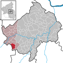
Becherbach bei Kirn is an Ortsgemeinde – a municipality belonging to a Verbandsgemeinde, a kind of collective municipality – in the Bad Kreuznach district in Rhineland-Palatinate, Germany. It belongs to the Verbandsgemeinde of Kirn-Land, whose seat is in the town of Kirn, although this lies outside the Verbandsgemeinde. Becherbach bei Kirn should not be confused with Becherbach. Becherbach bei Kirn has borne the tag “bei Kirn” since 1 July 1969, at which time both municipalities found themselves in the same district as a result of administrative reform.
Becherbach bei Kirn is situated on the Großbach in the North Palatine Uplands between the Nahe and the Glan.
Clockwise from the north, Becherbach bei Kirn’s neighbours are the municipality of Heimweiler, the municipality of Limbach, the municipality of Otzweiler (all in the Bad Kreuznach district) and the municipality of Schmidthachenbach (in the Birkenfeld district).
Unearthed within Becherbach’s limits have been archaeological finds bearing witness to a settlement here during Roman times.
Lying as it did on a trade road that linked the Kirn area with the Glan valley, Becherbach was in the Middle Ages the administrative and judicial seat for a whole series of villages in the surrounding area. Belonging to the court of Becherbach were the villages of Becherbach, Krebsweiler, Heimberg, Limbach, Otzweiler, Schmidthachenbach and Thal, a hamlet of four households in 1599 whose inhabitants enjoyed certain special privileges. This place has since vanished, and it is now uncertain as to where it lay. Named as possible sites for it have been a spot near Castle Naumburg and a location between Otzweiler and Becherbach. The Unteramtsbezirk of Becherbach was part of the Amt of Naumburg, which was made up of the courts of Bärenbach, Martin-Weierbach, Oberhachenbach, Oberreidenbach, Löllbach and, of course, Becherbach. This Amt of Naumburg was ceded by the Raugraves, a sideline of the Waldgraves, to the Counts of Sponheim-Kreuznach, first half of it in 1349, and then the whole towards the end of the 14th century. The Amt administrative seat was Castle Naumburg near Bärenbach, which had its first documentary mention, along with its owner, Raugrave Emich, in 1146.
...
Wikipedia


