Beacon Hill, Boston
|
Beacon Hill Historic District
|
|

Park Street, looking toward the Massachusetts State House
|
|
| Location | Boston, Massachusetts |
|---|---|
| Built | 1795 |
| Architect | Charles Bulfinch |
| Architectural style | Colonial Revival, Greek Revival, Federal |
| NRHP Reference # | 66000130 |
| Significant dates | |
| Added to NRHP | October 15, 1966 |
| Designated NHLD | December 19, 1962 |
Beacon Hill is a historic neighborhood in Boston, Massachusetts. According to the 2010 U.S. Census, the population of Boston's Beacon Hill neighborhood is 9,023.
It is a neighborhood of Federal-style rowhouses and is known for its narrow, gaslit streets and brick sidewalks. Today, Beacon Hill is regarded as one of the most desirable and expensive neighborhoods in Boston.
Because the Massachusetts State House is in a prominent location at the top of the hill, the term "Beacon Hill" is also often used as a metonym in the local news media to refer to the state government or the legislature.
Like many similarly named areas, the neighborhood is named for the location of a former beacon atop the highest point in central Boston. The beacon was used to warn the residents of an invasion.
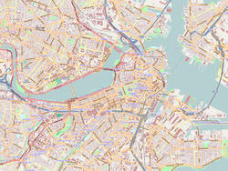
Beacon Hill is bound by Storrow Drive, and Cambridge, Bowdoin, Park and Beacon Streets. It is about one mile square, and situated along the riverfront of the Charles River Esplanade to the west, just north of Boston Common and the Boston Public Garden. The block bound by Beacon, Tremont and Park Streets is included as well. Beacon Hill has three sections: the south slope, the north slope and the "Flat of the Hill", which is a level neighborhood built on landfill. It is west of Charles Street and between Beacon Street and Cambridge Street.
Located in the center of the Shawmut Peninsula, the area originally had three hills, Beacon Hill and two others nearby; Pemberton Hill and Mount Vernon, which were leveled for Beacon Hill development. The name trimount later morphed into "Tremont", as in Tremont Street. Between 1807 and 1832 Beacon Hill was reduced from 138 feet in elevation to 80 feet. The shoreline and bodies of water such as the Mill Pond had a "massive filling", increasing Boston's land mass by 150%. Charles Street was one of the new roads created from the project.
...
Wikipedia


