Bayfield (town), Wisconsin
| Bayfield, Wisconsin | |
|---|---|
| Town | |

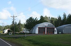
Town garage
|
|
| Coordinates: 46°50′21″N 90°55′23″W / 46.83917°N 90.92306°WCoordinates: 46°50′21″N 90°55′23″W / 46.83917°N 90.92306°W | |
| Country | United States |
| State | Wisconsin |
| County | Bayfield |
| Area | |
| • Total | 134.0 sq mi (347.0 km2) |
| • Land | 89.2 sq mi (230.9 km2) |
| • Water | 44.8 sq mi (116.1 km2) |
| Elevation | 794 ft (242 m) |
| Population (2010) | |
| • Total | 680 |
| • Density | 8/sq mi (2.9/km2) |
| Time zone | Central (CST) (UTC-6) |
| • Summer (DST) | CDT (UTC-5) |
| Area code(s) | 715 & 534 |
| FIPS code | 55-05375 |
| GNIS feature ID | 1582765 |
| Website | www |
Bayfield is a town in Bayfield County, Wisconsin, United States. The population was 680 at the 2010 census. The unincorporated communities of Pureair and Salmo are located in the town, as are Eagle Island and Sand Island of the Apostle Islands.
Wisconsin Highway 13 serves as a main arterial route in the community.
The town of Bayfield has the shape of a capital "L", extending north into the main body of Lake Superior and east into a channel of the lake between the mainland and Madeline Island. The city of Bayfield is located on the shore of Lake Superior and surrounded by the eastern leg of the town.
According to the United States Census Bureau, the town has a total area of 134.0 square miles (347.0 km2), of which 89.2 square miles (230.9 km2) is land and 44.8 square miles (116.1 km2), or 33.45%, is water.
As of the census of 2000, there were 625 people, 261 households, and 194 families residing in the town. The population density was 7.0 people per square mile (2.7/km2). There were 491 housing units at an average density of 5.5 per square mile (2.1/km2). The racial makeup of the town was 79.52% White, 14.72% Native American, 0.16% Asian, 0.48% from other races, and 5.12% from two or more races. Hispanic or Latino of any race were 1.12% of the population.
...
Wikipedia
