Bay of La Paz
| La Paz | |||
|---|---|---|---|
| City | |||

Boardwalk of La Paz
|
|||
|
|||
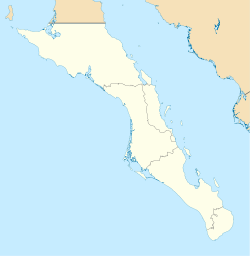
| Location of La Paz in Baja California Sur | |||
| Coordinates: 24°08′32″N 110°18′39″W / 24.14222°N 110.31083°WCoordinates: 24°08′32″N 110°18′39″W / 24.14222°N 110.31083°W | |||
| Country | Mexico | ||
| State | Baja California Sur | ||
| Municipality | La Paz | ||
| Founded | May 3, 1535 | ||
| named La Paz | 1596 | ||
| Government | |||
| • Municipal president | Lic. Esthela Ponce Beltran (PRI) | ||
| Elevation | 27 m (89 ft) | ||
| Population (2010) | |||
| • City | 215,178 | ||
| • Urban | 215,178 | ||
| Data source: INEGI | |||
| Time zone | MST (UTC−7) | ||
| • Summer (DST) | MDT (UTC−6) | ||
| Website | http://www.lapaz.gob.mx | ||
| Source: Enciclopedia de los Municipios de México | |||
La Paz (![]() la ˈpas , Peace) is the capital city of the Mexican state of Baja California Sur and an important regional commercial center. The city had a 2010 census population of 215,178 people, but its metropolitan population is somewhat larger because of surrounding towns such as el Centenario, el Zacatal and San Pedro. Its surrounding municipality, which is the fourth-largest municipality in Mexico in geographical size, reported a population of 251,871 persons living on a land area of 20,275 km2 (7,828 sq mi).
la ˈpas , Peace) is the capital city of the Mexican state of Baja California Sur and an important regional commercial center. The city had a 2010 census population of 215,178 people, but its metropolitan population is somewhat larger because of surrounding towns such as el Centenario, el Zacatal and San Pedro. Its surrounding municipality, which is the fourth-largest municipality in Mexico in geographical size, reported a population of 251,871 persons living on a land area of 20,275 km2 (7,828 sq mi).
La Paz was first inhabited by Neolithic hunter-gatherers at least 10,000 years ago who left traces of their existence in the form of rock paintings near the city and throughout the Baja California Peninsula. On May 3, 1535, Hernán Cortés arrived in the bay by La Paz and named it "Santa Cruz"; he attempted to start a colony but abandoned his efforts after several years due to logistical problems. In 1596 Sebastián Vizcaíno arrived, giving the area its modern name, La Paz.
From January 10, 1854 to May 8, 1854 it served as the capital of William Walker's Republic of Sonora. The project collapsed due to lack of US support and pressure from the Mexican government to retake the region.
...
Wikipedia


