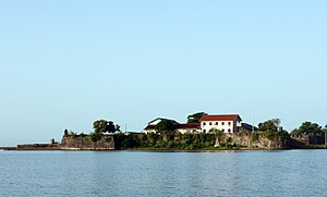
Batticaloa Fort
| Batticaloa Fort Portuguese/Dutch Fort |
|
|---|---|
| Part of Batticaloa | |
| Batticaloa, Sri Lanka | |

Batticaloa Fort
|
|
| Coordinates | 7°42′43″N 81°42′09″E / 7.711901°N 81.702377°E |
| Type | Defence fort |
| Site information | |
| Controlled by | Government of Sri Lanka |
| Open to the public |
Yes |
| Condition | Good |
| Site history | |
| Built | 1628 |
| Built by | Portuguese and Dutch |
| Materials | Granite Stones and coral |
| Battles/wars | Several battles |
The Batticaloa Fort (Sinhalese: මඩකලපුව බලකොටුව; Tamil: மட்டக்களப்புக் கோட்டை) was built by the Portuguese in 1628 and was captured by the Dutch on 18 May 1638. Later, the fort was used by British from 1745.
The fort has a structure of four bastions and is protected by the Batticaloa Lagoon on two sides and a canal on the other two sides. The fort is still in reasonable condition and currently houses several local administrative departments of the Sri Lanka government in new buildings, which are located within the old structure.
Timeline of Batticaloa fort in colonial time.
Antique print of the Batticaloa Fort by Baldaeus, 1672
A view from the main entrance (south-east)
Cannon at the top, looking towards Kallady bridge/Indian ocean. Watchtower in one of the bastions
...
Wikipedia

