Batavia, OH
| Batavia, Ohio | |
|---|---|
| Village | |

Looking east along Main Street
|
|
| Motto: Historic past – Bright future | |
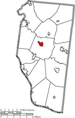
 Location of Batavia, Ohio |
|
 Location of Batavia in Clermont County |
|
| Coordinates: 39°4′38″N 84°10′45″W / 39.07722°N 84.17917°WCoordinates: 39°4′38″N 84°10′45″W / 39.07722°N 84.17917°W | |
| Country | United States |
| State | Ohio |
| County | Clermont |
| Township | Batavia |
| Settled | Fall 1797 |
| Platted | October 24, 1814 |
| Incorporated | February 10, 1842 |
| Government | |
| • Mayor | John Q. Thebout |
| Area | |
| • Total | 1.62 sq mi (4.20 km2) |
| • Land | 1.59 sq mi (4.12 km2) |
| • Water | 0.03 sq mi (0.08 km2) |
| Elevation | 594 ft (181 m) |
| Population (2010) | |
| • Total | 1,509 |
| • Estimate (2012) | 1,630 |
| • Density | 949.1/sq mi (366.4/km2) |
| Time zone | Eastern (EST) (UTC−5) |
| • Summer (DST) | EDT (UTC−4) |
| ZIP code | 45103 |
| Area code | 513 |
| FIPS code | 39-04150 |
| GNIS feature ID | 1037672 |
| Website | bataviavillage |
Batavia (/bəˈteɪviə/buh-TAY-vee-uh) is a village in and the county seat of Clermont County, Ohio, United States. The population was 1,509 at the 2010 census.
Batavia is located at 39°4′38″N 84°10′45″W / 39.07722°N 84.17917°W (39.077332, -84.179160).
According to the United States Census Bureau, the village has a total area of 1.62 square miles (4.20 km2), of which 1.59 square miles (4.12 km2) is land and 0.03 square miles (0.08 km2) is water. It is surrounded by Batavia Township.
Batavia is located along Ohio State Route 32, also known as the Appalachian Highway, a major east-west highway that connects Interstate 275 and the Cincinnati area to the rural counties of Southern Ohio. State Routes Ohio State Route 132 and 222 also pass through the village's downtown area.
...
Wikipedia
