Barwaha
|
Barwaha बड़वाह |
|
|---|---|
| city | |
|
Narmada Bridge
|
|
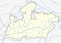
| Location in Madhya Pradesh, India | |
| Coordinates: 22°15′14″N 76°02′13″E / 22.254°N 76.037°ECoordinates: 22°15′14″N 76°02′13″E / 22.254°N 76.037°E | |
| Country |
|
| State | Madhya Pradesh |
| Region | Nimar |
| District | Khargone District |
| Government | |
| • Type | Municipal Board |
| Population (2011) | |
| • Total | 39,973 |
| Languages | |
| • Official | Hindi, English, Nimadi |
| Time zone | IST (UTC+5:30) |
| Telephone code | 07280 |
| Vehicle registration | MP 10 |
Barwaha is a municipality in Khargone district in the state of Madhya Pradesh, India. The Barwaha city is divided into 18 wards for which elections are held every 5 years. The Barwaha Municipality has population of 39,973 of which 20,940 are males while 19,033 are females as per report released by Census India 2011. Literacy rate of Barwaha city is 87.27% higher than state average of 69.32%. In Barwaha, Male literacy is around 92.73% while female literacy rate is 81.23%.
Barwaha Municipality has total administration over 5,133 houses to which it supplies basic amenities like water and sewerage. It is also authorized to build roads within Municipality limits and impose taxes on properties coming under its jurisdiction. This is a beautiful town situated on the banks of the Narmada River. It has got the largest CISF training campus in India. The city is surrounded by hundreds of very small villages and so is the main market area for those villages. On every Tuesday people from all these villages come to purchase their weekly required materials, whereas on Friday most of the shops remain closed.
Barwha is a Municipality in the District of Khargone is situated in the state of Madhya Pradesh in the central region of India. Khargone was formerly known as West Nimar. A part of the Indore Division lying on the region of Nimar, The District headquarters is located in the town of Khargone along with other functional offices i.e., police station, the collectorate office, telecom and other governmental organizations. Barwaha city famous its ghats and is built on the banks of River Narmada, surrounded by Ujjain, Indore and Dewas as its northern frontier, the state of Maharashtra Khandwa and Burhanpur as the southern side and Khargone and Barwani as the Western border. The people of Barwaha speak Namadi. It is the primary language in west Nimar, Bareli and Palya, the language of Bhil is spoken in the central territory of Madhya Pradesh; Bareli Rathwi, Bhil is written in Bhilali and Devanagari script.
In ancient times, the Haihayas of Mahishmati (present-day Maheshwar) ruled this region. In early medieval age, the area was under the Paramaras of Malwa and the Ahirs of Asirgarh. In late medieval age, the area was under Malwa Sultanate of Mandu. In 1531, Gujarat sultan Bahadur Shah brought this area under his control. In 1562, Akbar annexed this territory along with the whole Malwa to Mughal empire. In 1740 Marathas under the Peshwa brought the area under their control. In 1778, Peshwa distributed this territory to the Maratha rulers, Holkars of Indore, Sindhias of Gwalior and Ponwars of Dhar. After the independence and merger of the Princely states with Union of India in 1948, this territory became West Nimar district of Madhya Bharat. On November 1, 1956 this district became part of the newly formed state of Madhya Pradesh. On May 25, 1998 West Nimar district was bifurcated into two districts: Khargone and Barwani and Barwaha comes under Khargone District.
...
Wikipedia

