Barstow, California
| City of Barstow | |
|---|---|
| General law city | |

View of Barstow, looking northwest
|
|
| Motto: "Crossroads of Opportunity" | |
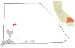
 Location of Barstow in San Bernardino County |
|
| Location in the United States | |
| Coordinates: 34°54′N 117°1′W / 34.900°N 117.017°WCoordinates: 34°54′N 117°1′W / 34.900°N 117.017°W | |
| Country | United States |
| State | California |
| County | San Bernardino |
| Incorporated | September 30, 1947 |
| Government | |
| • Type | Council-manager |
| • Mayor | Julie Hackbarth-McIntyre |
| • City council | Tim Silva, Merrill Gracey, Richard Harpole, and Carmen Hernandez |
| • City treasurer | Michael Lewis |
| • City manager | Curt Mitchell |
| • City clerk | JoAnne Cousino |
| Area | |
| • Total | 41.394 sq mi (107.209 km2) |
| • Land | 41.385 sq mi (107.186 km2) |
| • Water | 0.009 sq mi (0.023 km2) 0.02% |
| Elevation | 2,175 ft (663 m) |
| Population (April 1, 2010) | |
| • Total | 22,639 |
| • Estimate (2013) | 23,219 |
| • Density | 550/sq mi (210/km2) |
| Time zone | Pacific Time Zone (UTC−8) |
| • Summer (DST) | PDT (UTC−7) |
| ZIP codes | 92310–92312 |
| Area codes | 442/760 |
| FIPS code | 06-04030 |
| GNIS feature IDs | 1652670, 2409790 |
| Website | Barstow, California |
Barstow is a city in San Bernardino County, California, United States. The population was 22,639 at the 2010 census. Barstow is located 55 miles (89 km) north of San Bernardino.
Barstow is a major transportation center for the Inland Empire. Several major highways including Interstate 15, Interstate 40, California State Route 58, and U.S. Route 66 converge in the city. It is the site of a large rail classification yard, belonging to the BNSF Railway. The Union Pacific Railroad also runs through town using trackage rights on BNSF's main line to Daggett 10 miles (16 km) east, from where it heads to Salt Lake City and the BNSF heads to Chicago. Barstow is about 62 miles (100 km) from Baker, California and 111 miles (179 km) from Primm, Nevada. Barstow is almost exactly midway between Los Angeles, California (130 miles (210 km) southwest) and Las Vegas, Nevada (125 miles (201 km) northeast).
Barstow is home to Marine Corps Logistics Base Barstow and is the closest city to the Fort Irwin National Training Center.
The settlement of Barstow began in the late 1830s in the Mormon Corridor. Every fall and winter, as the weather cooled, the rain produced new grass growth and replenished the water sources in the Mojave Desert. People, goods and animal herds would move from New Mexico and later Utah to Los Angeles, along the Old Spanish Trail from Santa Fe, or after 1848, on the Mormon Road from Salt Lake City. Trains of freight wagons traveled back to Salt Lake City and other points in the interior. These travelers followed the course of the Mojave River, watering and camping at Fish Ponds on its south bank (west of Nebo Center) or 3.625 miles up river on the north bank, at a riverside grove of willows and cottonwoods, festooned with wild grapes, called Grapevines (later the site of North Barstow). In 1859, the Mojave Road followed a route was established from Los Angeles to Fort Mojave through Grapevines that linked eastward with the Beale Wagon Road across northern New Mexico Territory to Santa Fe.
...
Wikipedia

