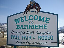
Barriere, British Columbia
| Barriere | |
|---|---|
| District municipality | |
| District of Barriere | |
 |
|
| Location of Barriere in British Columbia | |
| Coordinates: 51°10′59″N 120°7′21″W / 51.18306°N 120.12250°W | |
| Country |
|
| Province |
|
| District | Thompson-Nicola District |
| Incorporated | December 2007 |
| Government | |
| • MP | Cathy McLeod (Conservative) |
| • MLA | Terry Lake (Liberal) |
| Area | |
| • Land | 10.77 km2 (4.16 sq mi) |
| Population (2011) | |
| • Total | 1,773 |
| • Density | 164.7/km2 (427/sq mi) |
| Time zone | PST (UTC−8) |
| • Summer (DST) | PDT (UTC−7) |
| Area code(s) | 250 / 778 / 236 |
| Highways |
|
| Website | www.districtofbarriere.com |
Barriere is a district municipality in central British Columbia, Canada, located 66 kilometres (41 mi) north of the larger city of Kamloops on Highway 5. It is situated at the confluence of the Barrière River and North Thompson Rivers in the Central North Thompson Valley.
The community derives its name Barriere (originally and alternately, Barrière) from the rocks/nets placed in the water by first nations people to act as fish traps, forming a barrier to boat passage on the river. The descendants of those placing the fish-trap barriers are from the Simpcw/Secwepemc Nation, who still reside in present-day Chu Chua, just north of Barriere.
Gold was discovered in the area as early as 1861, and was mined using the placer method. The August 12, 1861 edition of the British Colonist mentions "...one party of Frenchmen at a place above Kamloops called Barrier (sic). They are fluming the Thompson, and expect to take out $25 per day to the hand, it is also incorpurated (sic)."
Depending upon where one resided, $25 could purchase an acre of land, a saddle, or double-barreled shotgun. To give some sense of proportion to these figures: Comparing $25 of daily productivity per hired hand to the price of a barrel of crude oil in 1861 ($0.49), the gold production would yield roughly more than 1,200 barrels (190 m3) of oil per hand per day.
In 2003, a major forest fire swept through the area surrounding Barriere and destroyed both homes and industry, most notably the Louis Creek sawmill, a large local employer. The fire burned the mountain above Barriere called Armor Mountain, in the Louis Creek zone. It also burned across the North Thompson river from Barriere, to Bonaparte Lake. At one point up to 3,000 were forced to evacuate the area. On July 26, 2008 a wildfire dragon monument was erected in Louis Creek to commemorate the determination and compassion of those who fought the flames and those who aided in the rebuilding of the community.
Barriere has a humid continental climate (Köppen climate classification Dfb) with cold winters and warm summers. Winters are cold and snowy with a January average of −6.5 °C (20 °F) and an average annual snowfall of 121 centimetres (48 in). Summers are warm and dry with a July high of 27.9 °C (82.2 °F) although temperatures above 30 °C (86 °F) occur 27 days in a year. The climate is dry, with an average annual precipitation is 486 millimetres (19 in).
...
Wikipedia

