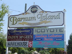
Barnum Island
| Barnum Island, New York | |
|---|---|
| Hamlet and census-designated place | |
 |
|
 Location in Nassau County and the state of New York. |
|
| Location within the state of New York | |
| Coordinates: 40°36′19″N 73°38′51″W / 40.60528°N 73.64750°WCoordinates: 40°36′19″N 73°38′51″W / 40.60528°N 73.64750°W | |
| Country | United States |
| State | New York |
| County | Nassau |
| Area | |
| • Total | 1.3 sq mi (3.4 km2) |
| • Land | 0.9 sq mi (2.4 km2) |
| • Water | 0.4 sq mi (1.0 km2) |
| Elevation | 0 ft (0 m) |
| Population (2010) | |
| • Total | 2,414 |
| Time zone | Eastern (EST) (UTC-5) |
| • Summer (DST) | EDT (UTC-4) |
| ZIP code | 11558 |
| Area code(s) | 516 |
| FIPS code | 36-04550 |
| GNIS feature ID | 1867393 |
Barnum Island is a hamlet and census-designated place (CDP) in Nassau County, New York, United States. The population was 2,414 at the 2010 census. It occupies the eastern portion of an island situated between Long Island and Long Beach. That island, previously known in its entirety as Hog Island, consists entirely of the communities of Barnum Island, Island Park, and Harbor Island.
Barnum Island is an unincorporated area of the Town of Hempstead. Most of Barnum Island is separated from the Village of Island Park by the LIRR's Long Beach Branch rail line to Long Beach.
Barnum Island has its own fire district and school district, but is under contract with the Village of Island Park for fire and education services for its residents. Barnum Island is included in the Island Park School District and ZIP code (11558).
Barnum Island is located at 40°36′19″N 73°38′51″W / 40.60528°N 73.64750°W (40.605203, -73.647403).
According to the United States Census Bureau, the CDP has a total area of 1.3 square miles (3.4 km2), of which 0.9 square miles (2.3 km2) is land and 0.4 square miles (1.0 km2) (28.24%) is water.
...
Wikipedia

