Barnes Air National Guard Base
|
Westfield-Barnes Regional Airport (formerly Barnes Municipal Airport) |
|||||||||||||||
|---|---|---|---|---|---|---|---|---|---|---|---|---|---|---|---|
 |
|||||||||||||||
| Summary | |||||||||||||||
| Airport type | Public | ||||||||||||||
| Owner | City of Westfield | ||||||||||||||
| Serves | Westfield / Springfield, Massachusetts | ||||||||||||||
| Elevation AMSL | 270 ft / 82 m | ||||||||||||||
| Coordinates | 42°09′29″N 072°42′57″W / 42.15806°N 72.71583°WCoordinates: 42°09′29″N 072°42′57″W / 42.15806°N 72.71583°W | ||||||||||||||
| Website | www.BarnesAirport.com | ||||||||||||||
| Map | |||||||||||||||
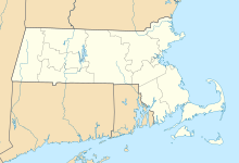
| Location of airport in Massachusetts | |||||||||||||||
| Runways | |||||||||||||||
|
|||||||||||||||
| Statistics (2010) | |||||||||||||||
|
|||||||||||||||
|
Source: FAA and airport website
|
|||||||||||||||
| Aircraft operations | 57,031 |
|---|---|
| Based aircraft | 155 |
Westfield-Barnes Regional Airport (IATA: BAF, ICAO: KBAF, FAA LID: BAF) is a public/military airport in Hampden County, Massachusetts, United States. It is owned by the City of Westfield and is three miles (6 km) north of it. The airport is northwest of the larger city of Springfield. Formerly known as Barnes Municipal Airport, it is included in the National Plan of Integrated Airport Systems for 2011–2015, which categorized it as a general aviation facility. Westfield-Barnes is one of Massachusetts' largest airports with a strong flight training, general aviation, and military presence.
July 13, 1914 can be the date upon which aviation came to Westfield. Jack McGee of Pawtucket, Rhode Island flew a Wright biplane over Westfield and the flight originated on a strip of land near Southampton Road and the Holyoke Rail Bridge. McGee was hired by local merchants to drop tickets from his airplane which could have been claimed for prizes.
Following the entry of the United States into World War I, however, the expansive plain was heavily utilized by the federal government in August–September 1917 as Camp Bartlett, a mobilization and training camp for the 103rd and 104th Infantry Regiments of the 26th "Yankee" Division, prior to deployment in France.
In 1923 citizens of Westfield, and nearby Holyoke set out to build an airport. A group of influential local businessmen was charged to convince the owner of the land where the airport is now, Vincent E. Barnes, to sell his land to the City of Westfield for an airport. Barnes agreed to give up his land and he didn't ask for any money from the city or the businessmen. The 27-acre (110,000 m2) plot was named Westfield Aviation Field and was dedicated on October 12, 1923. However, as the field gained in popularity, Vincent Barnes leased the city another 27-acre (110,000 m2) plot, with only a fee of $1 per year starting in 1927. In 1936, Mrs. Barnes and her daughter Saddie Knox donated an additional 297 acres (1.2 km²) to the city of Westfield. Shortly thereafter, the City Council voted to name the airport after the family who made it possible, Barnes.
...
Wikipedia

