Baras, Rizal
| Baras | ||
|---|---|---|
| Municipality | ||
 |
||
|
||
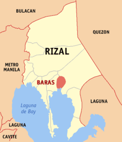
 Map of Rizal showing the location of Baras |
||
| Location within the Philippines | ||
| Coordinates: 14°31′N 121°16′E / 14.52°N 121.27°ECoordinates: 14°31′N 121°16′E / 14.52°N 121.27°E | ||
| Country | Philippines | |
| Region | CALABARZON (Region IV-A) | |
| Province | Rizal | |
| District | 2nd District of Rizal | |
| Founded | 1500 | |
| Barangays | 10 | |
| Government | ||
| • Mayor | Kathrine B. Robles | |
| Area | ||
| • Total | 84.93 km2 (32.79 sq mi) | |
| Population (2015 census) | ||
| • Total | 69,300 | |
| • Density | 820/km2 (2,100/sq mi) | |
| Time zone | PST (UTC+8) | |
| ZIP code | 1970 | |
| IDD : area code | +63 (0)2 | |
| Income class | 4th Class | |
| Website | www |
|
Baras is a fourth class municipality in the province of Rizal, Philippines. According to the 2015 census, it has a population of 69,300 people.
In 1595, the Franciscan missionaries under the leadership of Fr. Juan de Placencia and Fr. Diego de Oropesa, founded a “visita” for Morong on the present site of Bosoboso, south of Painaan with Apostol Santiago as its patron saint. It was known as “Visita de Santiago” or Santiago until such time that it became Baras. Baras was then inhabited by 400 Aetas and other mountain people.
In 1636, the town was transferred to a place called Ibayo, one and one-half leagues southeast of the first site due to the hostility of the Aetas and the mountaineers who burned part of the town and church in 1635. San Salvador became their patron saint. However, the town and church of Baras was burned by Chinese rebels in 1639, who were retreating from Manila to the Sierra Madre mountains.
The ecclesiastical administration of Baras was given back by the Jesuits to the Franciscan in 1679. Two years later In 1682, the town was transferred to its present site where they would not be menaced by marauding tribes of the mountaineers.
Baras was under the jurisdiction of the Province of Laguna from 1606 to 1853. Its administration was transferred to the newly created Distrito de las Monte de San Mateo in 1857. This district was changed to Distrito de Morong whose capital was in Antipolo but was later transferred to Morong.
In July 1895, the representatives of Katipunan came to inform the people of Morong, Tanay, Antipolo, Baras and Pililla about the cause of the secret society. The Katipuan of Baras established the Real or Military Camp at sitio of Gogo or Pamitinan. On November 21, 1896, the Katipunan attempted to capture the town of Morong but were driven by the Guardia Civil. By 1898, Baras had joined the Revolutionary Government of Emilio Aguinaldo.
After the defeat of the Spaniards in Morong, the Aguinaldo Headquarters ordered the establishment of the municipal township. A special election was held. However, the Revolutionary Government of Aguinaldo did not last because of the outbreak of the Filipino-American War. On March 29, 1900, Military Order No. 40, by Governor General Meritt came in effect. This order was for the election of an Alcalde Municipal, Vice Alcalde, and the Municipal Council. This was implemented in October of the same year.
...
Wikipedia


