Banyuwangi
|
Banyuwangi Regency Kabupaten Banyuwangi |
||||||
|---|---|---|---|---|---|---|
| Regency | ||||||
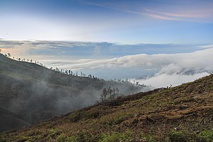
Clockwise, from top left : Ijen volcano complex, G-Land, Ketapang Harbour, Pulo Merah Islet
|
||||||
|
||||||
| Motto: Satya Bhakti Praja Mukti (official) The Sunrise of Java (informal) |
||||||
 Location in East Java |
||||||
| Location in Indonesia | ||||||
| Coordinates: 8°10′8″S 113°42′8″E / 8.16889°S 113.70222°E | ||||||
| Country |
|
|||||
| Province |
|
|||||
| Government | ||||||
| • Regent | Abdullah Azwar Anas | |||||
| Area | ||||||
| • Total | 5,782.4 km2 (2,232.6 sq mi) | |||||
| Population (2014) | ||||||
| • Total | 1,599,788 | |||||
| • Density | 280/km2 (720/sq mi) | |||||
| Time zone | WIB (UTC+7) | |||||
| Area code(s) | +62-333 | |||||
| Website | Official site | |||||
Banyuwangi Regency is located at the easternmost end of Java Island. It serves as a port between Java and Bali. It is surrounded by mountains and forests to the west; by sea to the east and south. Banyuwangi is separated by the Strait of Bali from Bali. With an area of 5,782.4 km2, this regency is the largest in Java. It had a population of 1,488,791 according to the 2000 Census; by the 2010 Census it had risen to 1,556,078; and the latest official estimate (for January 2014) is 1,599,788. The city of Banyuwangi is the administrative capital. The name Banyuwangi is Javanese for "fragrant water", connected to the Javanese folklore of Sri Tanjung.
One Banyuwangi native group is the Osing community which has a Hindu culture although they can be considered as a Javanese sub-ethnic group. They live mainly in the central part of Banyuwangi and they sometimes consider themselves as Majapahit descendants. Other groups are Javanese (living mostly in the south and west), Madurese (mainly in the north and coastal area) and Balinese (scattered but more concentrated in the east). Other smaller groups include Chinese, Buginese, and Arabs.
Once known as Blambangan (or its variation: Balambangan and Balumbungan), it was a vassal of the Majapahit Kingdom and a regional trade centre. After the Majapahit Kingdom ceased to exist, it became an independent kingdom and, as such, the last Hindu kingdom of Java. In order to defend itself from the troops of the Sultanate of Demak, which tried to occupy it, Blambangan asked for help from Balinese kings, which caused it to lose its independence to Balinese kingdoms. During this time Blambangan was deeply influenced by Balinese culture. After around 150 years of Balinese occupation, the Sultanate of Mataram gained control of the territory and renamed it Banyuwangi. Later, it was part of the Mataram territory controlled by the VOC (1770). During the expansion of plantations in the 19th century, many parts of Banyuwangi were planted with coffee and sugar cane, which feature its landscape even now. The Chinese and Arabs came mostly during this period.
...
Wikipedia


