Bannau Sir Gaer
| Picws Du\Bannau Sir Gaer | |
|---|---|

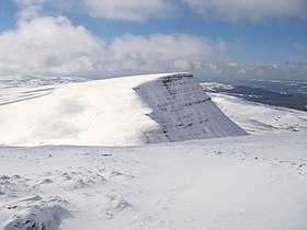
Picws Du from Fan Brycheiniog
|
|
| Highest point | |
| Elevation | 749 m (2,457 ft) |
| Prominence | 93 m (305 ft) |
| Parent peak | Fan Brycheiniog |
| Listing | Hewitt, Nuttall, sub HuMP |
| Coordinates | 51°52′57″N 3°43′40″W / 51.8826°N 3.7277°WCoordinates: 51°52′57″N 3°43′40″W / 51.8826°N 3.7277°W |
| Geography | |
| Location | Carmarthenshire, Wales |
| Parent range | Brecon Beacons |
| OS grid | SN825217 |
| Listed summits of Picws Du | ||||
| Name | Grid ref | Height | Status | |
|---|---|---|---|---|
| Waun Lefrith | SN969193 | 677 metres (2,221 ft) | Nuttall | |
Picws Du is the second highest peak of the Carmarthen Fans (or, in Welsh Bannau Sir Gaer) in the Carmarthenshire section of the Black Mountain in the west of the Brecon Beacons National Park in south Wales. The highest peak is Fan Foel immediately next along the ridge and it is a subsidiary summit of Fan Brycheiniog. Picws Du falls within Fforest Fawr Geopark and its prominent summit is marked by a large Bronze Age round barrow at a height of 2457 feet above sea level. Waun Lefrith is the other, lower summit of the Bannau Sir Gaer / Carmarthen Fans situated to the west. The peak overlooks the glacial lake of Llyn y Fan Fach in the cwm below. As the peak sits on the edge of the escarpment on a ridge which juts out into the valley below, the views from the summit are panoramic and extensive. The views to the north are especially impressive when the weather is clear, looking towards the Cambrian Mountains, Mynydd Epynt and Brecon. Swansea and the Bristol Channel can just be seen on the horizon to the south, across the gently falling dip slope. Pen y Fan and Corn Du are distinctive landmarks seen directly to the east across Fforest Fawr.
Picws Du is formed from the sandstones and mudstones of the Brownstones Formation of the Old Red Sandstone laid down during the Devonian period. Its summit and southern slopes are formed from the hard-wearing sandstones of the overlying Plateau Beds Formation which are of upper/late Devonian age. The northwestern and northeast faces of Picws Du were home to small glaciers during the ice ages which gouged out the cirque of Pwll yr Henllyn and Pant y Bwlch. These cwms drain via the Afon Sawdde into the River Towy to the west. They also drain into the River Usk to the north, which then drains into the Usk Reservoir, visible from the summit of the mountain in the middle distance. The southern slopes drain into the Afon Twrch and the slopes to the east so into the River Tawe. The glacial lake of Llyn y Fan Fach is situated below the summit to the west, and is only slightly smaller than its companion Llyn y Fan Fawr about 2 miles to the east. There are several large linear moraines below the cliffs, similar to that below Fan Hir, and some of which retain small pools.
...
Wikipedia
