Balsam Lake, Wisconsin
| Balsam Lake, Wisconsin | |
|---|---|
| Village | |

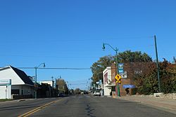
Downtown Balsam Lake
|
|
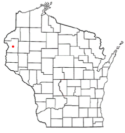
 Location of Balsam Lake, Wisconsin |
|
| Coordinates: 45°27′02″N 92°27′17″W / 45.4506814°N 92.4548533°WCoordinates: 45°27′02″N 92°27′17″W / 45.4506814°N 92.4548533°W | |
| Country | United States |
| State | Wisconsin |
| County | Polk |
| Area | |
| • Total | 3.39 sq mi (8.78 km2) |
| • Land | 2.16 sq mi (5.59 km2) |
| • Water | 1.23 sq mi (3.19 km2) |
| Elevation | 1,089 ft (332 m) |
| Population (2010) | |
| • Total | 1,009 |
| • Estimate (2012) | 985 |
| • Density | 467.1/sq mi (180.3/km2) |
| Time zone | Central (CST) (UTC-6) |
| • Summer (DST) | CDT (UTC-5) |
| Area code(s) | 715 & 534 |
| FIPS code | 55-04475 |
| GNIS feature ID | 1582746 |
Balsam Lake is a village in, and the county seat of, Polk County, Wisconsin, United States. The population was 1,009 at the 2010 census. The village is located within the Town of Balsam Lake.
The area in and around Balsam Lake was originally inhabited by a large band of Chippewa Indians. They referred to the area as "Innenehinduc," which means "place of the evergreen." This may have been due to the large amount of Canadian Yew, an evergreen shrub, which grew in abundance there.
The town was organized on January 8, 1870, and was named after the lake that lay within its borders. The first businesses included a blacksmith shop, a bank, a creamery, two sawmills, a hardware store, and a general store. Governmental buildings included a courthouse and a log schoolhouse.
Today, Balsam Lake is the home of the Polk County Government Center.
The town celebrates its history, and the history of the United States, with its annual Freedom Festival, which takes place on the Thursday through Sunday surrounding the Fourth of July.
Balsam Lake is located at 45°27′28″N 92°27′17″W / 45.45778°N 92.45472°W (45.45805, -92.454872).
According to the United States Census Bureau, the village has a total area of 3.39 square miles (8.78 km2), of which, 2.16 square miles (5.59 km2) of it is land and 1.23 square miles (3.19 km2) is water.
As of the census of 2010, there were 1,009 people, 434 households, and 257 families residing in the village. The population density was 467.1 inhabitants per square mile (180.3/km2). There were 732 housing units at an average density of 338.9 per square mile (130.9/km2). The racial makeup of the village was 94.2% White, 0.9% African American, 2.6% Native American, 0.3% Asian, 0.5% from other races, and 1.6% from two or more races. Hispanic or Latino of any race were 0.7% of the population.
...
Wikipedia
