Balmorhea, Texas
| Balmorhea, Texas | |
|---|---|
| City | |
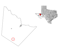
 Location of Balmorhea, Texas |
|
 |
|
| Coordinates: 30°59′2″N 103°44′32″W / 30.98389°N 103.74222°WCoordinates: 30°59′2″N 103°44′32″W / 30.98389°N 103.74222°W | |
| Country | United States |
| State | Texas |
| County | Reeves |
| Area | |
| • Total | 0.4 sq mi (1.0 km2) |
| • Land | 0.4 sq mi (1.0 km2) |
| • Water | 0.0 sq mi (0.0 km2) |
| Elevation | 3,196 ft (974 m) |
| Population (2010) | |
| • Total | 479 |
| • Density | 1,200/sq mi (480/km2) |
| Time zone | Central (CST) (UTC-6) |
| • Summer (DST) | CDT (UTC-5) |
| ZIP code | 79718 |
| Area code(s) | 432 |
| FIPS code | 48-05468 |
| GNIS feature ID | 1351473 |
Balmorhea (/ˌbælməˈreɪ/ BAL-mə-RAY) is a city in Reeves County, in the U.S. state of Texas. The population was 479 in the U.S. Census of 2010.
Balmorhea was platted in 1906. The town's name is an amalgamation of Balcom, Morrow, and Rhea, the surnames of its founders.
Balmorhea is located at 30°59′2″N 103°44′32″W / 30.98389°N 103.74222°W (30.983894, -103.742292).
According to the United States Census Bureau, the city has a total area of 0.4 square miles (1.0 km2), all land. Just outside the town, Balmorhea Lake provides irrigation water for the local communities.
As of the census of 2000, there were 527 people, 179 households, and 139 families residing in the city. The population density was 1,359.6 people per square mile (521.7/km²). There were 242 housing units at an average density of 624.3 per square mile (239.6/km²). The racial makeup of the city was 58.82% White, 29.41% from other races, and 11.76% from two or more races. Hispanic or Latino of any race were 87.10% of the population.
...
Wikipedia
