Bakote
|
Abbottabad, Pakistan ایبٹ آباد |
|
|---|---|
| District | |

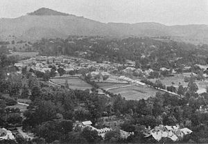
A picture of Abbottabad city taken in 1907
|
|
| Coordinates: 34°00′N 73°00′E / 34.000°N 73.000°ECoordinates: 34°00′N 73°00′E / 34.000°N 73.000°E | |
| Country | Pakistan |
| Province | Khyber Pakhtunkhwa |
| Headquarters | Abbottabad |
| Area | |
| • Total | 1,967 km2 (759 sq mi) |
| Population (2017) | |
| • Total | 1,332,912 |
| • Density | 680/km2 (1,800/sq mi) |
| Time zone | PKT (UTC+5) |
| Number of Union Councils | 51 |
| Number of Tehsils | 2 |
| Languages (1981) | 92.32% Hindko 7.67% Pashto |
| Website | www |
Abbottabad District (Urdu: ایبٹ آباد) is located in Khyber Pakhtunkhwa province of Pakistan. The district covers an area of 1,969 km2, with the city of Abbottabad being the principal town. Neighbouring districts are Mansehra to the north, Muzaffarabad to the east, Haripur to the west, and Rawalpindi to the south.
The district is named after Major James Abbott, the first deputy commissioner of Hazara (1849–1853).
During British rule Abbottabad became the capital of Hazara division, which was named after and contained the Hazara valley, a small valley in the outermost Himalayas, between the Indus in the west and Kashmir in the east.
The current Abbottabad District was originally a tehsil of Hazara, the Imperial Gazetteer of India described it as follows:
The population counted in 1998 census was 881,000. According to an estimate this had risen to 1.05 million in 2008. according to the old Hazara gazetteers the main tribes here are the Karlal (Sardar), Turks, Dhund Abbasis, Tanolis, Tareen's, Awans,Sulemankhel, Jadoons, Qureshi, Mughals, Gujjars, Syeds and Sattis.
...
Wikipedia
