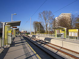
Baguley tram stop
| Baguley | |
|---|---|
| Metrolink | |
 |
|
|
Location of Baguley in Greater Manchester
|
|
| Location | |
| Place | Baguley |
| Local authority | City of Manchester |
| Coordinates | 53°23′54″N 2°17′36″W / 53.3982°N 2.2932°WCoordinates: 53°23′54″N 2°17′36″W / 53.3982°N 2.2932°W |
| Platforms | 2 |
| Fare zone information | |
| Metrolink Zone | R |
| Present status | In operation |
| History | |
| Opened | 2014 |
|
|
|
Baguley tram stop is a tram stop on the Airport Line, built for phase 3B of the Manchester Metrolink to Manchester Airport. It opened on 3 November 2014. It is on Southmoor Road next to Roundthorn Industrial Estate and the Royal Oak Tesco.
It is proposed to link with a proposed station in a future Northern line from Altrincham to .
Trams run every 12 minutes north to Cornbrook and south to Manchester Airport (every 20 minutes to Firswood before 6 am).
Trains are scheduled to run along the Stockport-Altrincham line between Manchester Piccadilly station and Chester, where trains currently run every hour in the off-peak period. However, additional trains are proposed between Greenbank and which could give Baguley 4 trains per hour.
...
Wikipedia

