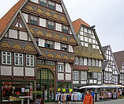
Bad Salzuflen
| Bad Salzuflen | ||
|---|---|---|
 |
||
|
||
| Coordinates: 52°05′15″N 8°45′02″E / 52.08750°N 8.75056°ECoordinates: 52°05′15″N 8°45′02″E / 52.08750°N 8.75056°E | ||
| Country | Germany | |
| State | North Rhine-Westphalia | |
| Admin. region | Detmold | |
| District | Lippe | |
| Government | ||
| • Mayor | Roland Thomas (SPD) | |
| Area | ||
| • Total | 100.05 km2 (38.63 sq mi) | |
| Population (2015-12-31) | ||
| • Total | 53,341 | |
| • Density | 530/km2 (1,400/sq mi) | |
| Time zone | CET/CEST (UTC+1/+2) | |
| Postal codes | 32105, 32107, 32108 | |
| Dialling codes | 05222, in border areas 0521, 05221, 05232, 05266, 05208, 05228 | |
| Vehicle registration | LIP | |
| Website | www.stadt-bad-salzuflen.de | |
Bad Salzuflen is a town and thermal spa resort in the Lippe district of North Rhine-Westphalia, Germany. At the end of 2013, it had 52,121 inhabitants.
Bad Salzuflen lies on the eastern edge of the Ravensberg Basin, at the confluence of the rivers Salze (Bega) with the Werre. In comparison to other North Lippe communities it is densely populated. The city centre is surrounded by districts with a village like feel to them and agricultural land. North east of the River Werre and Salze (Bega) runs a strand of the Lipper highlands runs through the largely wooded hills with elevations up to 250 meters in the city. The lowest point is on the border of the River Werre at Herford at about 70 meters. Since 2008, the city is part of the Teutoburg Forest Nature Park / Eggegebirge.
The municipal area is crossed by the river floodplains of the Werre, and Salze. Podzol and Stagnosol brown soils prevail as soil types. The podzolic soils are mainly found in layers from the Tertiary Period, which are crossed by fault block from the Mesozoic. Characteristic of Bad Salzuflen are the saline springs that emerge at these geological folds and which give the region the name of "Germany's healing garden".
The geothermal heat sources are of sufficient quality that it makes it viable to use heat recovery systems utilising borehole heat exchangers and heat pumps.
The part of Bad Salzulfen classified as the main central town covers an area of 100.06 square kilometres (38.63 sq mi). The municipal area has a roughly oval shape, with a maximum extension in east–west direction and 13 km in north–south direction of 11 km.
Bad Salzuflen is bordered to the east by the town of Lemgo, to the south by Lage and on the southwest by Leopoldshöhe. All three communities are part of the district of Lippe. To the west lies the county town of Bielefeld and in the north west, the city of Herford. To the north Bad Salzuflen borders on Vlotho in the district of Herford. Together with Herford, Bad Salzuflen belongs to conurbation of Bielefeld.
...
Wikipedia


