Bad Rock Canyon
| Bad Rock Canyon | |
|---|---|

A view of the Flathead River flowing west through Bad Rock Canyon and a BNSF eastbound oil train.
|
|
| Floor elevation | approx. 2,910 feet (900 m) |
| Long-axis length | 2.75 miles (4.43 km) |
| Width | .25 to .50 miles (0.40 to 0.80 km) |
| Geography | |
| Coordinates | 48°23′09″N 114°06′30″W / 48.385724°N 114.108453°WCoordinates: 48°23′09″N 114°06′30″W / 48.385724°N 114.108453°W |
| Watercourses | Flathead River |
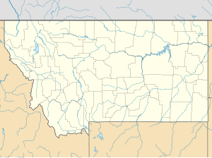
Bad Rock Canyon is a river canyon lying 2.64 miles (4.25 km) east of Columbia Falls, Montana. The Flathead River, flanked by U.S. Highway 2, flows through the canyon and enters Montana’s Flathead Valley.Rock slides occur frequently along the northern side of the BNSF Railway tracks that run through the canyon.
For centuries the canyon was a part of the buffalo trail leading through the Rocky Mountains to the buffalo hunting grounds on the Great Plains. Towns nearest the canyon are Hungry Horse immediately to the east and Martin City father to the east. The town of Coram lies a few miles father northeast, about 5 miles from the western entrance of Glacier National Park at West Glacier, Montana.
The plateau tribes—Kalispel, Pend d'Oreilles (Upper Kalispel), Spokane, Coeur d’Alene, and Kootenai—as well as the nearby Flathead tribe would pass through this area for their buffalo hunts. Plains tribes, primarily the Blackfeet, would travel through the area seeking to capture the good horses raised by the western tribes. Oral tradition suggests that some battles may have taken place in the canyon.
...
Wikipedia

