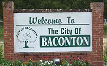
Baconton, Georgia
| Baconton, Georgia | |
|---|---|
| City | |
| Motto: | |
 Location in Mitchell County and the state of Georgia |
|
| Coordinates: 31°22′34″N 84°9′41″W / 31.37611°N 84.16139°WCoordinates: 31°22′34″N 84°9′41″W / 31.37611°N 84.16139°W | |
| Country | United States |
| State | Georgia |
| County | Mitchell |
| Area | |
| • Total | 1.3 sq mi (3.3 km2) |
| • Land | 1.3 sq mi (3.3 km2) |
| • Water | 0 sq mi (0 km2) |
| Elevation | 174 ft (53 m) |
| Population (2010) | |
| • Total | 915 |
| • Density | 618.5/sq mi (243.6/km2) |
| Time zone | Eastern (EST) (UTC-5) |
| • Summer (DST) | EDT (UTC-4) |
| ZIP code | 31716 |
| Area code(s) | 229 |
| FIPS code | 13-04840 |
| GNIS feature ID | 0331077 |
| Website | cityofbacontonga.com |
Baconton is a city in Mitchell County, Georgia, United States. As of the 2010 census, the city had a population of 915.
Baconton is located at 31°22′34″N 84°9′41″W / 31.37611°N 84.16139°W (31.376002, -84.161468).
According to the United States Census Bureau, the city has a total area of 1.3 square miles (3.4 km2), all land.
Soils of Baconton are mostly well drained or somewhat excessively drained. They have grayish brown loamy sand topsoils overlying yellowish brown or red sandy clay loam subsoils. All belong to the Ultisol soil order. Where agricultural or urban development have not occurred, these soils support mixed forests dominated by pines and oaks.
As of the census of 2000, there were 804 people, 289 households, and 212 families residing in the city. The population density was 626.5 people per square mile (242.5/km²). There were 310 housing units at an average density of 241.5 per square mile (93.5/km²). The racial makeup of the city was 59.83% African American, 37.56% White, 0.87% Native American, 0.12% Pacific Islander, 0.50% from other races, and 1.12% from two or more races. Hispanic or Latino of any race were 1.12% of the population.
...
Wikipedia

