Bünzen, Switzerland
| Bünzen | ||
|---|---|---|
 |
||
|
||
| Coordinates: 47°19′N 8°20′E / 47.317°N 8.333°ECoordinates: 47°19′N 8°20′E / 47.317°N 8.333°E | ||
| Country | Switzerland | |
| Canton | Aargau | |
| District | Muri | |
| Area | ||
| • Total | 5.77 km2 (2.23 sq mi) | |
| Elevation | 441 m (1,447 ft) | |
| Population (Dec 2015) | ||
| • Total | 1,031 | |
| • Density | 180/km2 (460/sq mi) | |
| Postal code | 5624 | |
| SFOS number | 4229 | |
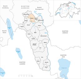
| Surrounded by | Besenbüren, Boswil, Hermetschwil-Staffeln, Waltenschwil | |
| Website |
www SFSO statistics |
|
Bünzen is a municipality in the district of Muri in the canton of Aargau in Switzerland.
Prehistoric items have been found scattered on the banks of the former moraine, as well as Roman era objects. The modern municipality of Bünzen is first mentioned in 1259 as Bunzina. In 1321 Muri Abbey acquired a Meierhof farm and church rights in Bünzen from Markwart of Rüssegg. After the conquest of the Aargau in 1415, the Swiss Confederation placed the village in the Hermetschwil district. The rights to low justice were held by the administrator of the Meierhof.
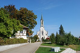
In 1328 the village church, under the authority of Muri Abbey, was incorporated. In 1412 the church was given Saint George as a patron saint. Today's neo-Gothic parish church building was built in 1862 at the northern exit of the village. It replaced the earlier church from 1508.
Bünzen has an area, as of 2009[update], of 5.77 square kilometers (2.23 sq mi). Of this area, 3.51 km2 (1.36 sq mi) or 60.8% is used for agricultural purposes, while 1.64 km2 (0.63 sq mi) or 28.4% is forested. Of the rest of the land, 0.58 km2 (0.22 sq mi) or 10.1% is settled (buildings or roads), 0.02 km2 (4.9 acres) or 0.3% is either rivers or lakes and 0.02 km2 (4.9 acres) or 0.3% is unproductive land.
Of the built up area, housing and buildings made up 5.0% and transportation infrastructure made up 3.8%. Out of the forested land, all of the forested land area is covered with heavy forests. Of the agricultural land, 52.3% is used for growing crops and 8.3% is pastures. All the water in the municipality is in rivers and streams.
...
Wikipedia


