Aylmer, Gatineau, Quebec
| Aylmer | |
|---|---|
| Sector within City of Gatineau | |

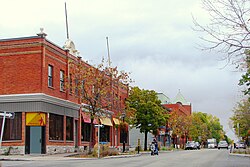
Rue Principale (Main Street)
|
|
| Coordinates: 45°24′00″N 75°51′00″W / 45.40000°N 75.85000°WCoordinates: 45°24′00″N 75°51′00″W / 45.40000°N 75.85000°W | |
| Country |
|
| Province |
|
| Region | Outaouais |
| RCM | Gatineau |
| Incorporated | July 1, 1855 |
| Merged | January 1, 2002 * |
| Area | |
| • Land | 88.86 km2 (34.31 sq mi) |
| Population (2011) 2011 census |
|
| • Total | 55,113 |
| • Change ~2001 | +15.1% |
| • Dwellings | 15,370 |
| Demonym(s) | Aylmerite |
| Time zone | EST (UTC-5) |
| • Summer (DST) | EST (UTC-4) |
| Area code(s) | 819 |
| Access Routes |
|
| * Merged with Gatineau on January 1, 2002 | |
Aylmer is a former city in Quebec, Canada. Located on the Ottawa River and Route 148, in 2002 it amalgamated into the Quebec city of Gatineau, which is a component part of Canada's National Capital Region. Aylmer's population in 2011 was 55,113. It is named after Lord Aylmer, who was a Governor General of British North America and a Lieutenant Governor of Lower Canada from 1830 to 1835.
It bills itself as the "Recreation Capital of the National Capital", given its many golf courses, green spaces, spas, marina and bicycle paths. There is little industry in the sector, the area being mainly residential. Virtually all the major shops, services and restaurants are located along Chemin d'Aylmer. The sector's indoor swimming pool and skateboard park are also located on that road.
Aylmer's population is about 30% anglophone; 61% francophoneand 9% other; much of its workforce commutes across the river to Ottawa.
Prior to its foundation, parts of Aylmer, like most surrounding areas of the Ottawa region, were often occupied as summer camps by the Algonquin First Nation population. The first European explorers known to reach the actual location of Aylmer were Nicolas-du-Vigneau and Samuel de Champlain during the early 17th century in their explorations west of Quebec City. It was only during the early 19th century that colonization began in the region; during the same period the foundations of the communities of Hull and Bytown were being established. In 1800, agricultural lots were given to Philemon Wright, an American from Massachusetts who was the first major developer/pioneer of the Ottawa Valley and Wright, in turn, gave most of his lots to his sons to operate as farms. The road leading west from Wright's Town was named the Britannia Turnpyke and the waterfront at its western extremity was Turnpyke's End, eventually renamed Symmes Landing and finally known as Aylmer.
...
Wikipedia
