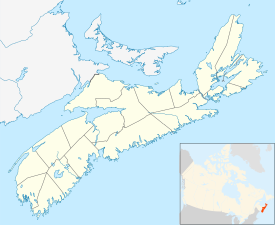
Aylesford, Nova Scotia
| Aylesford | |
|---|---|
| Village | |
| Location of Aylesford, Nova Scotia | |
| Coordinates: 45°02′0″N 64°50′00″W / 45.03333°N 64.83333°W | |
| Country |
|
| Province |
|
| County | Kings |
| Electoral Districts Federal |
West Nova |
| Provincial | Kings West |
| Elevation | 32 m (105 ft) |
| Population (2011) | |
| • Total | 2,408 |
| Time zone | AST (UTC-4) |
| • Summer (DST) | ADT (UTC-3) |
| Canadian Postal code | B0P 1C0 |
| Area code(s) | 902 |
| Telephone Exchange | 847 |
| NTS Map | 021H02 |
| GNBC Code | CABCE |
Aylesford is a farming community in the county of Kings in the Annapolis Valley of Nova Scotia, Canada. It is located between the North and South Mountains and located roughly 15 minutes from CFB Greenwood and 10 minutes from Berwick. Aylesford is located on the Evangeline Trail (Trunk 1) tourist route, named after the famous Acadian story about Evangeline.
Aylesford is one of the oldest communities in Kings County, originally settled by United Empire Loyalists during the American Revolution. The settlement was named after the fourth Earl of Aylesford, Lord of the Bedchamber to George III. Kingston emerged as a major centre for packing, processing and exporting apples after the arrival of the Windsor and Annapolis Railway in 1869.
Aylesford's economy relies primarily on the local agricultural industry. It is a service centre for the surrounding agricultural district. An important crop is cranberries cultivated on the extensive peat bogs. Peat moss harvesting operations are also active.
Aylesford's largest tourist attraction, the Oaklawn Farm Zoo, was home to Rutledge, the heaviest living lion in captivity, as certified by Guinness World Records in 1997. Rutledge died in February 2009, three months short of his 18th birthday. The zoo also has a variety of other animals including tigers, dromedary camels, and a variety of monkeys.
...
Wikipedia

