Atwood, Kansas
| Atwood, Kansas | |
|---|---|
| City | |

Rawlins County Courthouse (2010)
|
|
| Motto: "Pride of the Prairie" | |
 Location within Rawlins County and Kansas |
|
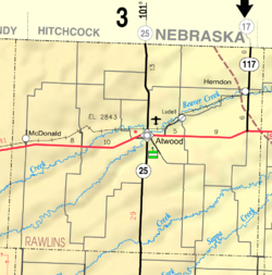
 KDOT map of Rawlins County (legend) |
|
| Coordinates: 39°48′32″N 101°2′29″W / 39.80889°N 101.04139°WCoordinates: 39°48′32″N 101°2′29″W / 39.80889°N 101.04139°W | |
| Country | United States |
| State | Kansas |
| County | Rawlins |
| Area | |
| • Total | 1.10 sq mi (2.85 km2) |
| • Land | 1.04 sq mi (2.69 km2) |
| • Water | 0.06 sq mi (0.16 km2) |
| Elevation | 2,858 ft (871 m) |
| Population (2010) | |
| • Total | 1,194 |
| • Estimate (2015) | 1,187 |
| • Density | 1,100/sq mi (420/km2) |
| Time zone | Central (CST) (UTC-6) |
| • Summer (DST) | CDT (UTC-5) |
| ZIP code | 67730 |
| Area code(s) | 785 |
| FIPS code | 20-03150 |
| GNIS feature ID | 0470991 |
| Website | AtwoodKansas.com |
Atwood is a city in and the county seat of Rawlins County, Kansas, United States. As of the 2010 census, the city population was 1,194.
In 1875, T.A. Andrews and J.M. Matheny traveled to Rawlins County and started a town site about two miles east of the current city. The city of Attwood (with two t's) was named after Attwood Matheny, the 14-year-old son who accompanied his father on the journey. In 1882, the U.S. Post Office requested permission to drop one "t" thus becoming Atwood. In 1881, Atwood became the county seat of Rawlins County.
Atwood is located at 39°48′32″N 101°2′29″W / 39.80889°N 101.04139°W (39.808971, -101.041370). According to the United States Census Bureau, the city has a total area of 1.10 square miles (2.85 km2), of which 1.04 square miles (2.69 km2) is land and 0.06 square miles (0.16 km2) is water.
According to the Köppen Climate Classification system, Atwood has a semi-arid climate, abbreviated "BSk" on climate maps.
As of the census of 2010, there were 1,194 people, 568 households, and 299 families residing in the city. The population density was 1,148.1 inhabitants per square mile (443.3/km2). There were 666 housing units at an average density of 640.4 per square mile (247.3/km2). The racial makeup of the city was 97.2% White, 0.2% African American, 0.3% Native American, 0.1% Asian, 1.0% from other races, and 1.3% from two or more races. Hispanic or Latino of any race were 2.9% of the population.
...
Wikipedia
