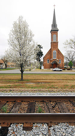
Atkins, Arkansas
| Atkins | |
|---|---|
| City | |

Atkins
|
|
| Location in Arkansas. | |
| Coordinates: 35°14′37″N 92°56′18″W / 35.24361°N 92.93833°WCoordinates: 35°14′37″N 92°56′18″W / 35.24361°N 92.93833°W | |
| Country | United States |
| State | Arkansas |
| County | Pope |
| Area | |
| • Total | 6.1 sq mi (15.9 km2) |
| • Land | 6.1 sq mi (15.9 km2) |
| • Water | 0 sq mi (0 km2) |
| Elevation | 371 ft (113 m) |
| Population (2010) | |
| • Total | 3,016 |
| • Density | 471.8/sq mi (181/km2) |
| Time zone | Central (CST) (UTC-6) |
| • Summer (DST) | CDT (UTC-5) |
| ZIP code | 72823 |
| Area code(s) | 479 |
| FIPS code | 05-02590 |
| GNIS feature ID | 0045966 |
Atkins is a city in Pope County, Arkansas, United States. The population was 3,016 at the 2010 census. It is part of the Russellville Micropolitan Statistical Area.
Atkins is located at 35°14′37″N 92°56′18″W / 35.24361°N 92.93833°W (35.243485, -92.938212).
According to the United States Census Bureau, the city has a total area of 6.1 square miles (16 km2), all of it land. Many Atkins residents commute to nearby Russellville, Arkansas for work, school, and recreation due to its close location.
As of the census of 2010, there were 3,016 people, 1,118 households, and 849 families residing in the city. The population density was 471.8 people per square mile (181/km²). There were 1,288 housing units at an average density of 211.1 per square mile (81/km²). The racial makeup of the city was 95.6% White, 0.9% Black or African American, 0.8% Native American, 0.1% Asian, 1.2% from other races, and 1.2% from two or more races. 2.3% of the population were Hispanic or Latino of any race.
...
Wikipedia

