Atholville, New Brunswick
| Atholville | ||
|---|---|---|
| Village | ||

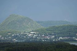
View of Sugarloaf from Atholville
|
||
|
||
| Location of Atholville in New Brunswick | ||
| Coordinates: 47°59′22″N 66°42′45″W / 47.989444°N 66.7125°W | ||
| Country |
|
|
| Province |
|
|
| County | Restigouche | |
| Parish | Addington | |
| Village Status | 1966 | |
| Electoral Districts Federal |
Madawaska—Restigouche |
|
| Provincial | Campbellton-Restigouche Centre | |
| Government | ||
| • Type | Village Council | |
| • Mayor | Michel Soucy (term 2012-2016) | |
| • Deputy Mayor | Maurice Power | |
| • Councillors |
List of Members
|
|
| Area | ||
| • Land | 10.25 km2 (3.96 sq mi) | |
| Population (2011) | ||
| • Total | 1,237 | |
| • Density | 120.7/km2 (313/sq mi) | |
| • Pop 2006-2011 |
|
|
| • Dwellings | 588 | |
| Time zone | AST (UTC-4) | |
| • Summer (DST) | ADT (UTC-3) | |
| Postal code(s) |
|
|
| Area code(s) | 506 | |
| Access Routes |
|
|
| Website | www.atholville.net | |
Atholville (2011 population: 1,237) is a village in Restigouche County, New Brunswick, Canada.
The first inhabitants of the area were the Mi'kmaq who settled there in the 6th century BC and were then called Tjikog. With 400 people, it was their biggest village and the only one permanently inhabited in the region. The Acadians arrived in 1750. It was at this time that the Mi'kmaq left the area and went to Listuguj in Quebec. The French defeat at the Battle of Restigouche on 8 July 1760 was damaging to the development of the settlement. The Intercolonial Railway, however, was inaugurated in 1876 and Anglophone merchants developed the forestry industry in the early 20th century. The village then experienced significant growth and was incorporated as a municipality in 1966. A shopping centre frequented by people from the whole region was established there from 1974. The forestry industry still plays an important role in the local economy.
Atholville's population is mostly Acadian but there is also a substantial anglophone minority. The village has several community services and facilities, including Sugarloaf Provincial Park.
Related article: Geography of New Brunswick.
Atholville is located four kilometres west of downtown Campbellton. The village, although a francophone community of the Atlantic provinces of Canada, is generally considered part of Acadia. Atholville is bordered to the north by the Restigouche River and has an area of 10.25 square kilometres. Apart from Campbellton the village is adjacent to Val-d'Amours to the south and Tide Head to the west. The Quebec side extends, from west to east, from Restigouche-Partie-Sud-Est to Pointe-à-la-Croix and Listuguj.
...
Wikipedia


