Ashtead
| Ashtead | |
|---|---|
 Ashtead Park House, since 1920s a school |
|
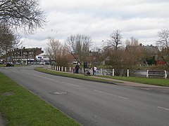
 Barnett Wood Lane with pond to the right |
|
| Ashtead shown within Surrey | |
| Area | 11.59 km2 (4.47 sq mi) |
| Population | 14,169 (2011 census) |
| • Density | 1,223/km2 (3,170/sq mi) |
| OS grid reference | TQ1858 |
| Civil parish |
|
| District | |
| Shire county | |
| Region | |
| Country | England |
| Sovereign state | United Kingdom |
| Post town | Ashtead |
| Postcode district | KT21 |
| Dialling code | 01372 |
| Police | Surrey |
| Fire | Surrey |
| Ambulance | South East Coast |
| EU Parliament | South East England |
| UK Parliament | |
Ashtead /ˈæʃstɛd/ is a village in the Metropolitan Green Belt of Surrey, England and has a railway station on secondary routes to Horsham and Guildford, formerly the Portsmouth Main Line. It is separated from Leatherhead by the M25, and from Epsom by Ashtead Common and Langley Vale. Its district council is Mole Valley. Ashtead is on western slopes of the Mole Gap of the North Downs and is on the A24 where it is a single carriageway as is generally the case within the M25 motorway. Ashtead has a large two-part conservation area including the mansion Ashtead House used by City of London Freemen's School, and six other schools. Amenities include parks, outlying woodland trails and a high street with convenience shopping, cafés and restaurants, a football club and a cricket club.
There has been settlement in Ashtead since at least Roman times, with a Roman villa excavated in what is now Ashtead common. Ashtead within a few hundred years of the foundations of Anglo-Saxon England lay within the Copthorne hundred.
...
Wikipedia

