Ash Grove Township, Iroquois County, Illinois
| Ash Grove Township | |
|---|---|
| Township | |
 Location in Iroquois County |
|
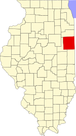
 Iroquois County's location in Illinois |
|
| Coordinates: 40°37′06″N 87°50′37″W / 40.61833°N 87.84361°WCoordinates: 40°37′06″N 87°50′37″W / 40.61833°N 87.84361°W | |
| Country | United States |
| State | Illinois |
| County | Iroquois |
| Established | November 6, 1855 |
| Area | |
| • Total | 61.09 sq mi (158.2 km2) |
| • Land | 61.03 sq mi (158.1 km2) |
| • Water | 0.06 sq mi (0.2 km2) 0.10% |
| Elevation | 669 ft (204 m) |
| Population (2010) | |
| • Total | 731 |
| • Density | 12/sq mi (5/km2) |
| Time zone | CST (UTC-6) |
| • Summer (DST) | CDT (UTC-5) |
| ZIP codes | 60924, 60926, 60953, 60955 |
| GNIS feature ID | 0428605 |
Ash Grove Township is one of twenty-six townships in Iroquois County, Illinois, USA. As of the 2010 census, its population was 731 and it contained 316 housing units.
The first settler in the area that became Ash Grove Township was Robert Roberts, who arrived in 1833. The township was formed when township government was adopted by the county in 1855. Its current borders were established on September 15, 1868 when Fountain Creek Township was formed from a portion of Ash Grove Township.
According to the 2010 census, the township has a total area of 61.09 square miles (158.2 km2), of which 61.03 square miles (158.1 km2) (or 99.90%) is land and 0.06 square miles (0.16 km2) (or 0.10%) is water.
(This list is based on USGS data and may include former settlements.)
The township contains these six cemeteries: Ash Grove, Cissna Park, Immanuel Lutheran, Saint John's Ash Grove, Saint Paul Lutheran and Schwer.
...
Wikipedia
