Arvaikheer
|
Arvaikheer District Арвайхээр сум ᠠᠷᠪᠠᠶᠢᠬᠡᠭᠡᠷᠰᠤᠮᠤ |
|
|---|---|
| District | |
| Official Cyrillic transcription(s) | |
| • Mongolian Cyrillic | Арвайхээр сум |
| Classical Mongolian transcription(s) | |
| • Mongolian script | ᠠᠷᠪᠠᠶᠢᠬᠡᠭᠡᠷᠰᠤᠮᠤ |

Sports' Palace
|
|
| Coordinates: 46°15′58″N 102°46′40″E / 46.26611°N 102.77778°E | |
| Country | Mongolia |
| Province | Övörkhangai Province |
| Area | |
| • Total | 173 km2 (67 sq mi) |
| Elevation | 1,817 m (5,961 ft) |
| Population (2010) | |
| • Total | 21,705 |
| • Density | 130/km2 (320/sq mi) |
| Time zone | UTC + 8 (UTC+8) |
| Area code(s) | +976 (0) 132 |
| Vehicle registration | ӨВ_ |
| Climate | BSk |
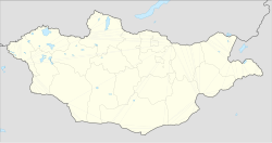
Arvaikheer (Mongolian: Арвайхээр; ᠠᠷᠪᠠᠶᠢᠬᠡᠭᠡᠷ), meaning "Barley Steppe," is the capital of Övörkhangai Aimag (province) and one of the most central points of Mongolia.
It is a centre for traditional crafts, goat herding and equestrian sports, and hosts a large regional horse festival every year. Arvaikheer has a population of 19,058 (2000 census), 23,298 (2004 est.), 24,954 (2006 est.), 25,622 (2008 est.). Arvaikheer is by far the largest town in the aimag.
Arvaikheer has a cold semi-arid climate (Köppen climate classification BSk) with mild summers and relatively mild winters by Mongolian standards. The 30 degrees Celsius difference between average January and average July temperature makes it the mildest place in Mongolia, along with Tsetserleg in Arkhangai Province. It is located in a microclimate in the center of Mongolia which sees less harsh winters than the rest of the country. Its 1,813 metres (5,948 ft) elevation at the foot of the eastern hills of the Khangai Mountains augments its mildness by keeping it distant from cold air pools in low basins. Most precipitation falls in the summer as rain, with some snow in March, April and October. Winters are very dry.
The Arvaykheer Airport has one unpaved runway and is served by regular flights to Ulaanbaatar and Altai. Arvaikheer is linked to Ulaanbaatar by a paved road and can be reached by public buses from the capital.
...
Wikipedia

