Arta, Djibouti
|
Arta Carta (Somali) أرتا (Arabic) |
|
|---|---|
| Town | |

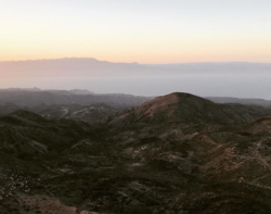
A view of the Gulf of Tadjoura from Arta.
|
|
| Location in Djibouti | |
| Coordinates: 11°31′N 42°50′E / 11.517°N 42.833°E | |
| Country |
|
| Region | Arta |
| Established | 17th century |
| Elevation | 755 m (2,477 ft) |
| Population | |
| • Total | 11,043 |
| Time zone | EAT (UTC+3) |
| Climate | BSh |
Arta (Arabic: أرتا, Somali: Carta) is a town in southeastern Djibouti. The center of the Arta Region, it is the country's sixth-largest city. As of 2010[update], the population was 11,043. Arta is situated on the Mountains of Arta and is famous for its mild climate. It is located some 35 kilometres (22 miles) west of the national capital, Djibouti City.
The Arta settlement is several centuries old. During the Middle Ages, it was ruled by the Ifat and Adal sultanates. Arta later formed a part of the French Somaliland protectorate in the first half of the 20th century. In the December 1942 British invasion of French Somaliland about 700 British troops and Free French troops occupied the town. Under French colonial rule in 1946, a new housing estate and hill station was built. Because of its usually dry and relatively cool weather, Arta was the summer residence of the French and Djiboutian people.
From 2 May 2000, peace talks between various factions of the Somali Civil War were held in the city with some 810 delegates, resulting in the establishment of the Transitional National Government of Somalia.
The town lies at an elevation of 755 metres (2,477 feet) above sea level. It sits on middle trending highlands known as the Mountains of Arta. The temperate central portion, where Arta lies, is situated on a rocky plateau.
...
Wikipedia

